We had been so lucky with the weather while on Inishmore, the largest of the three Aran Islands, for the previous two days with gloriously sunny weather the first day and just a tad chilly the second. I felt badly for those taking the ferry over from Rossaveal the day we left as the weather was pretty miserable.


There were four routes on the Sky Road; one we chose was 40 kms long included the site of the crash landing of the first transatlantic flight by Alcock and Brown in 1919, plus the old Marconi transatlantic wireless station. Roundstone, on the Sky Road, was one of the oldest fishing villages in Ireland.


A sign at Mannin Bay indicated there were 'kayak trails' people could take although neither Steven nor I had ever heard of them before. Kayakers could travel along the Island Trail following a rocky shoreline toward and around a small island. Or more experienced kayakers following the Headland Trail could follow a rocky and beach-lined shore but most of it would be difficult to land on. The cliffs along the coast were part of an upsurge of rock that began 460 million years ago.


Donkeys were first recorded in Ireland in the 19th century. They were originally used for milking but soon became an indispensable part of the farm. They were used to transport seaweed, potatoes, plough and work crops.


As we drove toward the town of Leenane, the road took us along Killarvey Harbor, an Irish example of fjord, a long, narrow body of water carved by an advancing glacier. The rows of floats were mussel farms with the mollusks growing on hanging nets in the cold seawater.


The tragic hike inspired an annual walk that commemorated the horrific period in Irish history. Archbishop Desmond Tutu made the walk in 1991 before South Africa ended apartheid. At the summit at the north end of the valley was the Doo Lough Valley Famine Memorial which consisted of a simple gray, stone cross. The inscription said it commemorated "the hungry poor who walked here in 1849 and walk the Third World today. Freedom for South Africa, 1994. Mahatma Gandhi said "How can men feel themselves honored by the humiliation of their fellow beings."

A little further on in Westport, we came to a modern bronze sculpture that depicted a 'coffin ship' like those that transported the starving Famine survivors in the late 1840s to Canada and the US in hope of new opportunities. As I walked around it, it sent shills up and down my spine.


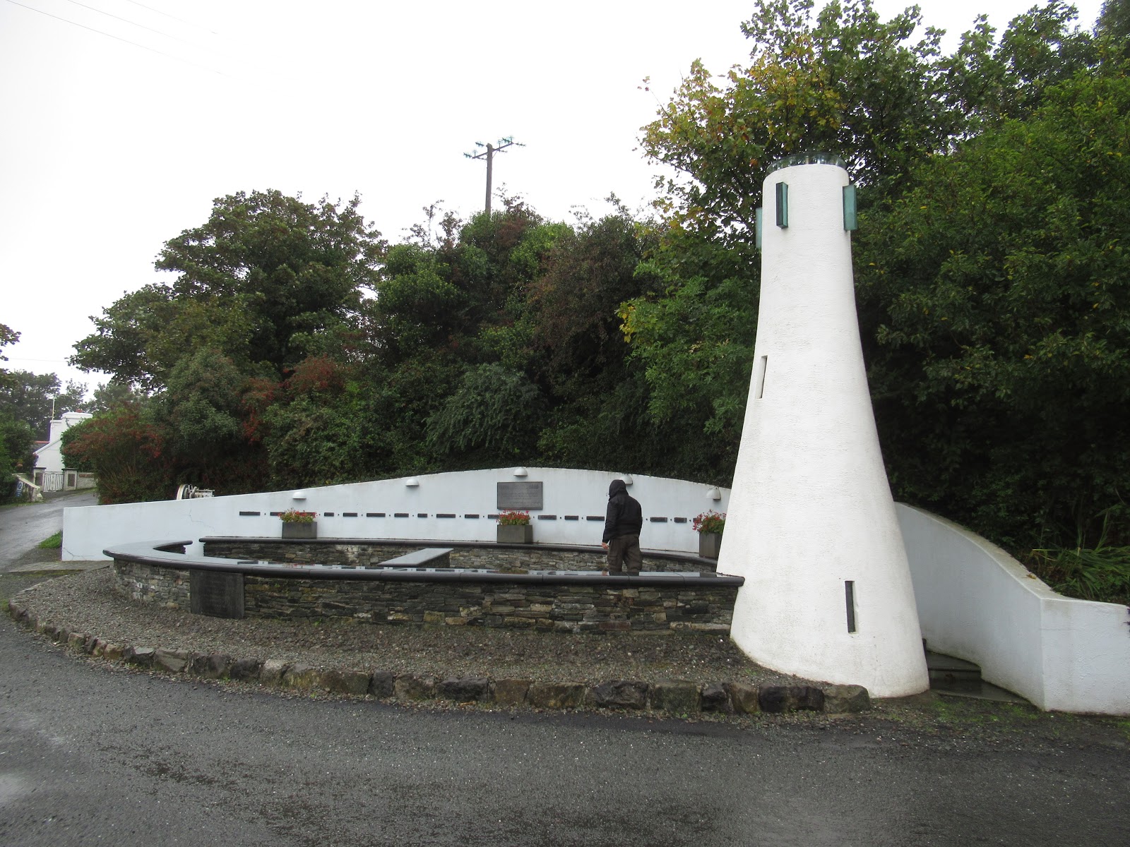
The monument was erected to honor the contribution of the traditional seafaring fishing community in Murrisk. "We celebrate their memory and ask you to remember all those who lost their lives in Clew Bay."


After picking up our car again, we drove north toward Quiet Man Bridge by Maam Cross as it was made famous in the 1950s classic film The Quiet Man starring John Wayne and Maureen O’Hara and regarded as one of the top 100 films ever made. I read later that tourists come from all over the world to visit this local attraction and some have also been known to take small pieces of stone from the bridge. Gee - I never thought of doing that!


The Irish sense of humor was at work in this carving of the Connemara Giant in County Galway. The plaque said “This is Connemara, built in 1999 by Joyce's Craft Shop for no apparent reason.” A nearby sign pointed out 'the late 20th century antiquity!'


This morning, October 15th, I received an email from The Wandering Earl, one of the regular travel blogs I follow. One of the items he mentioned was this: "When it's time to venture into the countryside, an afternoon drive along the stunning Sky Road in Clifden, Ireland is an absolute must." The timing was so funny as that stretch of spectacular scenery was what we did exactly a month ago today on September 15th! The road in County Galway took us out of Clifden with beautiful views of the Atlantic and rose 150m above sea level.


The light, the clouds and the changing moods of the Atlantic in this part of the Connemara have long inspired poets, writers and artists. The British author, William Makepeace Thackeray, wrote in 1842 "These wild mountains over which the clouds cast every variety of tint, light and shadow." The artist, Augustus John, described the Connemara region in 1917 as having "the most beautiful landscape in the world."


The area was so desolate I had to wonder how the people managed to exist here, how they eked out a living.


The area was a maritime Natura 2000 site, part of a larger network of sites throughout the European Union and also a special place for bottlenose dolphins that live here year round.

With the dreary weather, we didn't think we needed to worry about being Sun Smart that day!

More views of our drive along Sky Road along the striking Connemara Peninsula. The scenery was so beautiful I got almost no knitting done on my afghan as I didn't want to miss a thing!


We were so glad we'd opted to take the Sky Road toward Connemara National Park as it had been one of the most beautiful roads yet and that says a lot as Ireland had some gorgeous, gorgeous roads.


If I were a painter, this would have been a scene I would have chosen. If I could have bought an oil painting, I would have in a heartbeat.

Having been cooped up in the car for several hours, we were glad to hop out at the Connemara National Park's Visitors Center to go for a nature walk along the boardwalk raised above the bog.


The Connemara pony with its short back and well-defined head was Ireland's only native pony. It was perfectly adapted to the harsh terrain of Connemara and once used to work the bog and shore.

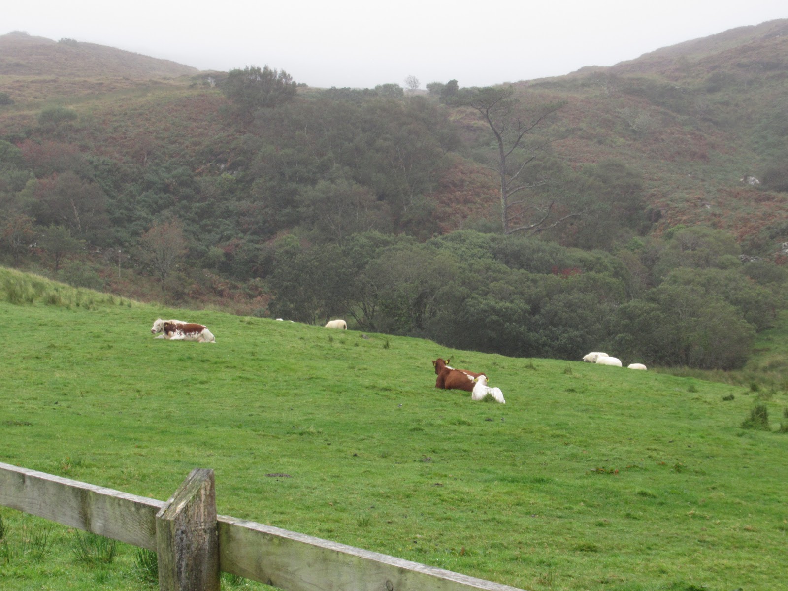
The Irish Moiled was one of the rarest native Irish breed of cattle and could be traced back to the 4th century. By the late 1970s, there were only 30 cows left in Ireland and, though numbers have increased, they are still classed as an endangered species. Maol is the Gaelic term for these cows and referred to their domed heads and lack of horns. They are generally red with a white line on their back and stomach.


We finally decided it was too wet to walk to reach the bog tracks so we drove toward Kylemore Abbey. The Neo-Gothic country home was built by a wealthy English businessman in the 1860s after he and his wife had honeymooned in the area. After WW I, refugee Benedictine nuns from Belgium ran an exclusive girl's school until it closed in 2010. Five years later, the University of Notre Dame signed a long lease to use part of the home for summer classes and student housing. Pretty swanky digs for students, don't you think?

The views from the lake shore were magical, I thought.

A little further on, we came across some areas where turf had been cut in a peat bog. Bogs once covered almost 20 percent of Ireland. As the climate warmed up at the end of the last Ice Age, plants grew along the sides of the many shallow ponds and lakes. When the plants died in these waterlogged areas, there wasn't enough oxygen for them to fully decompose. Through the centuries, moss built up layer upon dead layer, helping to slowly fill in the lakes.
It's this wet, oxygen-starved ecosystem that has inadvertently preserved so many ancient artifacts. If you read my post about our visit to the National Museum in Dublin, you may recall the wrinkled 'bog mummies' that were unearthed from 2,000 years ago! They were so amazingly intact that their hairstyles, eyelashes and even the the last meal in their stomachs could be identified!
The Irish have been cutting, drying and burning peat as a fuel for more than a thousand years. The process usually begins in late spring with the onset of drier weather. In the last few decades, bogs have been recognized as a rare habitat, and conservation efforts have been encouraged.


Killary Harbour was described as the most dramatic of Ireland's three fjords. Twenty thousand years ago, people could walk on ice from here to Norway. Glaciers carved out a U-shaped valley and as the ice melted, sea levels rose and flooded it. According to legend, the devil created the Devil's Pass by dragging St. Roc over the mountains on a chain.


At the east end of Killary Harbor were the scenic Aasleagh Falls.


We headed inland to the Doo Lough Valley between Louisburgh and Delphi which had some of the most desolate country in Ireland.


The lake was Doo Lough, Irish for Black Lake.

The valley, located in County Mayo, witnessed one of the darkest moments of the Great Potato Famine that plagued Ireland from 1845-1850. The rural people of County Mayo depended almost exclusively on the potato for food and were the hardest hit when the famine hit. On a bitterly cold day in the winter of 1849, about 600 starving Irish walked 12 miles from Louisburgh across the mountains following sheep tracks and wading streams to Delphi, hoping to get food from their landlord.

But, when they arrived at Delphi, they were turned away. On the way back, about 200 died by the side of this road of cold, hunger and exhaustion. Some were buried where they fell. The road seemed to still echo of the desperation of those starving people. James Berry wrote in 1910, "The sighing of the winds above their nameless graves forever sings their requiem."


The most popular wayside shrines in Ireland honored the Virgin Mary. This shrine to the infant Jesus and Our Lady of Victories was erected in 1951 at the foot of Croagh Patrick, a mountain pilgrimage destination. In the 5th century, St. Patrick was said to have fasted on the summit for the 40 days of Lent. The shrine stood near the place where many of the faithful were massacred while attending Mass. The great majority of Marian shrines were from the 'Marian Year' of 1954, the 100th anniversary of Pope Pius IX's 1854 of the dogma of the Immaculate Conception. A record number of devout Catholics converged on the nearby pilgrimage village of Knock to pray during the centenary. Many Irish girls born that year were called Marian.

The monument was erected to honor the contribution of the traditional seafaring fishing community in Murrisk. "We celebrate their memory and ask you to remember all those who lost their lives in Clew Bay."
We sure wouldn't go hungry while staying at The Helm in Westport eating meals with such huge portions!

This caramel concoction Steven and I shared was the bomb! I had to do a lot of walking the next day to make sure all these calories didn't remain on my hips!

Next post: Having a fun time exploring Westport before heading to Londonderry and County Donegal.
Posted on October 15th, 2019 on yet another stunning fall day in Littleton, Colorado.
Your photos made me feel cold and clammy. BRRRRR Janina
ReplyDelete