From the village of Kilronan on Inishmore, the largest of the three Aran Islands, we'd thought we'd take one of the many horse traps we'd seen yesterday that greeted everyone arriving off the ferry toward Dun Aengus, the 2,000 year old Stone Age Fort, located six miles away on the island's northwestern edge. We wanted to avoid the crowds at the fort when the ferry passengers all arrived but hadn't taken into account those horse traps wouldn't leave for another two hours - oops! We began walking on the Coast or Low Road toward the fort.
I loved the views along the Coast Road but it took us along the island's northwestern side and Dun Aengus was located on the southwestern side of the island so it involved quite a bit of extra walking. We figured we'd take the Main or High Road back to Kilronan as it traversed the middle of the island. That way, we'd have the opportunity to see all that we could of the island.
We were glad we'd not rented bikes that morning as we would have completely missed this small marker noting that Lawrence Conoch had been shot here by Crown forces (i.e. British) in December of 1920 during the country's struggle for independence. Conoch later died of his wounds.
Our first view of the massive cliffs overlooking the Atlantic Ocean that border the entire south side of the island:
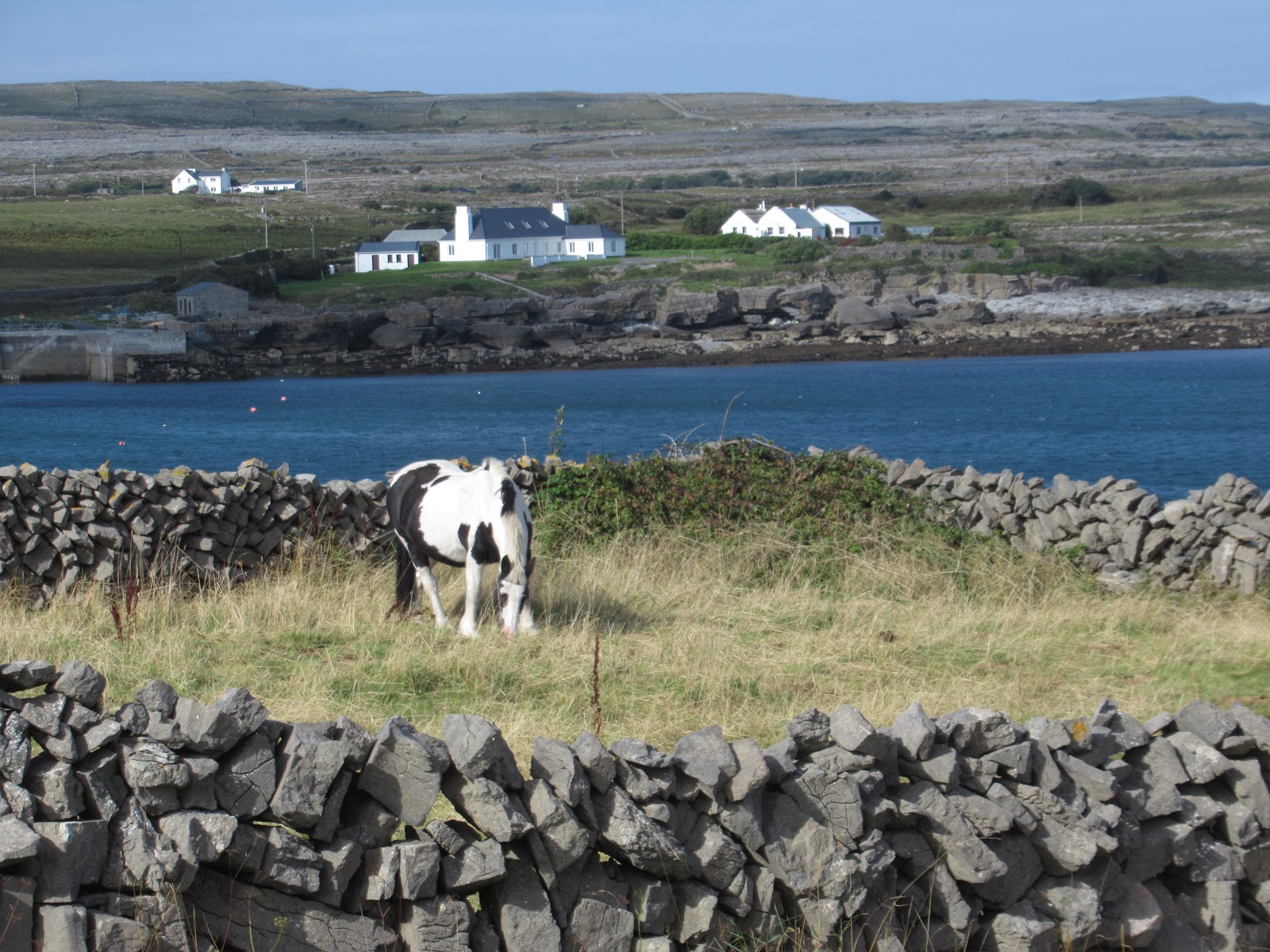
The sight of the drywall stone fences dividing up the fields was very striking. Can you imagine the time and backbreaking labor it must have taken collecting the rocks from the land and then making thousands of miles of fences from them?
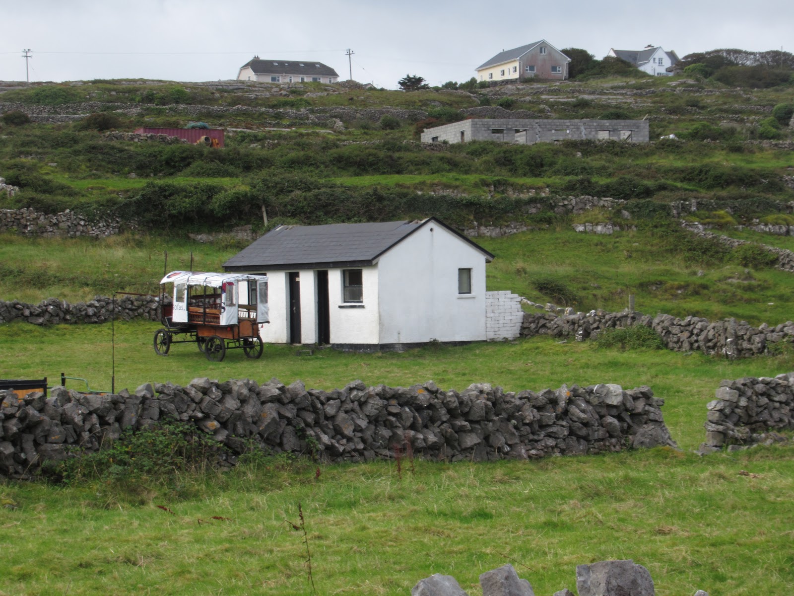
This was the first of what turned out to be several horse traps heading from the interior of the island toward the harbor at Kilronan to meet the morning ferry arriving from Rossaveal, near Galway.
As I mentioned in the previous post, the scene took me back 100 years!
We were glad we'd not rented bikes that morning as we would have completely missed this small marker noting that Lawrence Conoch had been shot here by Crown forces (i.e. British) in December of 1920 during the country's struggle for independence. Conoch later died of his wounds.
There was a stark beauty to what we were lucky enough to see. It was hard to know how the inhabitants managed to eke out a living from a mean sea and fewer than six inches of topsoil as so little of the land was productive.
A sign pointed to Teampall Chiarain, a 12th century church that was founded by a saint who studied under St. Edna whose half-submerged church we'd found yesterday on our hike to the southeastern part of the island.
Another horse and buggy was heading to the ferry.
As we'd seen the last few days, the terrain in the rugged, western part of Ireland was particularly poor and rocky. For generations, every spring farmers have had to 'harvest' rocks driven up by the winter frost to plant any crops. Irish farmers stacked these rocks into fences which divided the fields but had no visible gates.
Most of the fences were built in the typical Aran 'gap' style which meant spaces between angled upright stones were filled with smaller stones. That permitted a farmer who needed to move livestock from one field to another to slowly unstack the smaller rocks in a short section of the wall and then rebuild the wall after the cattle have passed through. A bonus of the drywall fences was that the harsh winter winds could blow right through without knocking them down
This was the first big horn sheep we noticed anywhere in Ireland.
The sign didn't do us much help as it was all in Gaelic!
I doubt we saw more than ten cars the two days we were on the island.
Further on we came across another of the gap or V-shaped fences.
Even though the coastal road was longer, scenes like the magnificent stone fences and then this bird sanctuary made it worth every moment.
Luckily, the seals had come out to play for us at Seal Beach! I loved how they sat so still so I could take photos.
The signs indicated we were still on the right track!
This was one of the few flowers I saw along the road.
For some reason. there were scads of cairns that had been built well beyond the seal colony. I had never seen so many in my life before in one spot!
I called this place Cairn Heaven!
We built this one in honor of my dear friend, Christine, who'd died very suddenly about six weeks earlier in Ottawa. Since her father was from Ireland, I liked to think she'd have really liked it.
Ahead was one of Ireland's many blue flag beaches which meant it had clean water and safe currents. As it was located on the narrowest section of the island, it also had the best grazing land nearby.
We joked we'd forgotten to bring our beach towels to hang out on this lovely beach! It was very windy, though, so it wouldn't have been the best day to relax on the beach.
Someone must have really loved his or dad!
We were really glad that Kilmurvey, the island's second largest village, was just up ahead as it meant we'd walked five miles and the stone fort was just another mile away! The word 'village' was pretty generous as it only consisted of a few shops, two soup and sandwich cafes, and a few homes.
While Steven relaxed out front, I made a beeline for the shop that sold hand-knit items. The motto in the shop could easily have been mine as I have loved to knit for close to 60 years since my mother taught me. Since arriving in Ireland, I'd begun kitting an afghan as we spent so much time in the car and I could knit while Steven drove. Thanks, Suellen, for the pattern you emailed me as it was easy to make and I now only have a few rows more to knit before I'm done.
A sign said it was an original Aran Islands shop and that Aran knitters had lived on the island for eight generations since 1798. It asked that people buy local and support the indigenous people.
This pattern was called Lobster Claws as they were found in such abundance on the west coast of Ireland.
There was so much to choose I had trouble deciding among headbands, hats and fingerless gloves.
From Kilmurvey on the north side of the island, we headed inland toward Dun Aengus on the south side.
Dun Aengus was a dramatic stone fort atop a cliff almost 300 feet above sea level. The oldest of the island's stone forts consisted of four sets of dry stone walls.
We were really fortunate that gale force winds weren't blowing that day as it would have been extremely dangerous, if not lethal, had we chosen to go any closer to the edge. There were no guardrails between us and the crumbling cliff. As travel writer Rick Steves wrote, "The Irish don't believe in litigation, just natural selection!"
I read that the fort was originally constructed in 1100 BC but was re-fortified around 700-800 AD. Excavations revealed significant evidence of prehistoric metalworking as well as several burials.
The long hike out to the fort had been exciting and great exercise but the fort hadn't been the blockbuster sight, in my opinion, as it had been described. Yes, it was incredibly neat to see so many dry stone walls in one place that had been built so, so long ago, but I had trouble envisioning what may have happened there.
We toyed with the idea of hiring a horse trap to take us back to Kilronan but decided to hoof it back via another road.
Steven thought we should return along a narrow and very rocky track instead of the busier Main or High Road but, after hiking for a mile or more, I finally said my feet had had enough of the very uneven terrain and I needed a paved road asap!
If I could have bought a painting of these fields and the endless stone fences, I would have done so in an instant as I found them so captivating.
There were supposed to be 400 types of flowers and 19 varieties of bees on the island but we saw very few flowers on our way to or from Dun Aengus.
The interestingly shaped house looked like it had been designed and positioned to take advantage of fabulous views in every direction.
Thank goodness we weren't on the island when strong winds would have caused the tree to look like this!
Another fairy house!
While walking along the road back to Kilronan, I had had my eyes peeled for the Aran Artisan Garden and was so happy when I finally noticed this was it! In front of the home was a creative garden spelling out LOVE in big block letters.
On a high spot overlooking the road was Eochall Church - how refreshing to see a church with four walls and a roof after all the church ruins we'd seen!
The shrine was tucked away off by itself with no sign as to why it had been placed there.
I wish I'd had some sugar cubes to feed these sweet horses!
Passing the school meant we were almost back at our B&B in Kilronan after a 12-mile hike through the central part of Inishmore. It had been a long and invigorating hike and one we both thoroughly enjoyed, even if it'd been a lot longer than we originally planned! The entire weekend on Inishmore had been everything we'd hoped - utterly relaxing getaway in one of Ireland's most picturesque spots. We decided the hikes each day on Inishmore certainly warranted being in our Top Ten of great walks we'd ever taken.
Next post: Back on the mainland and in the car to drive the Connemara Loop further west.
Posted on August 13th, 2019, after another gloriously sunny day in Littleton, Colorado. Happy Thanksgiving to my Canadian family and friends!


No comments:
Post a Comment