Before leaving tiny Valentia Island to explore more of the Ring of Kerry, we headed to the Tetrapod Trackway not far from the island's lighthouse we'd visited the morning before. We hadn't figured we'd start off the day with such an invigorating hike, but given we'd eaten another full Irish breakfast, mind you, it was probably a good idea to walk it off!

The view of the heather lining both sides of the path down to the tracks was lovely.


When we'd driven the southern part of the Ring of Kerry several days earlier, we'd spent some time at Staigue Fort, one of the three largest and best preserved prehistoric ring forts in all of Ireland. The other two were just 200 yards apart just north of Cahersiveen so we detoured to see them. Even though it was a bit dreary, we still had a very pleasant walk to the Lecanabuile Stone Fort passing some sheep farms. The name of the fort was Gaelic and meant "the slope of the Booley or summer cow pasture."


All the forts were roughly the same age with their circular dry-stone walls built somewhere between 500 BC and 300 AD without any mortar or cement. With walls that were 12 feet thick and 80 feet across, it's been estimated that the structures would have taken 100 men six months to build.


Through the morning mist we could pick out Cahergall Stone Fort, the last of the ring forts we'd be seeing.

Once we traipsed over to Cahergall, we read that stone forts, found mostly on the west side of Ireland, are notoriously difficult to date. Some like Staigue were from the Iron Age - about 500 BC to 400 AD - while many were simply stone versions of common earthen farmsteads of the Early Historic period from about 400-1200 AD.

As at the others, there were flights of stairs and terraces in the inner face of the wall. Within the fort there were the remains of a large dry-stone building which likely meant somebody of importance lived there 1,000 years ago.

Steven was like a mountain goat climbing the steps, never faltering or wavering on the rock steps! Me, on the other hand, not so much, but it was fun clambering on the rocks imagining who might have lived at each of the forts so long ago.


We didn't realize beforehand that Inch Strand was one of the locations for Ryan's Daughter, the 1969 David Lean film that starred Robert Mitchum and Trevor Howard.


Playboy of the Western World was also filmed on Inch Beach the following year.

We couldn't resist sharing this Iceberger treat!


Behind Minard Castle was Storm Beach where sandstone boulders had fallen from the nearby cliffs. The boulders, eroded into cigar-shaped rocks by wave and tidal action, had often been carried off by pre-Christian Celts and carved into ogham stones or monuments with linear writing.


Next post: Charming and colorful Dingle!
Posted on September 28th, 2019, from near Glasgow, Scotland, one of the aha cities as you will see when I get around to writing about our fun day here.


The impressions on the rocks were footprints of one of the first animals to walk on dry land and were 385 million years old! The lizard-like animal that was about three feet long not only left footprints but also faint tracks of a 'tail drag' that could be seen. That happened when the animal dragged itself out of the water and walked on wet mud. The prints would have rapidly filled with sand, and in time turned to rock.


This track, discovered in 1992, was the oldest in situ record in the world of a vertebrate or animal with a backbone walking on land. Before this, all known vertebrates were fish. Some of these began to live and feed in the shallow water along the edges of rivers. Gradually fins evolved into primitive legs. In addition, these animals developed the ability to breathe air out out of water. These were the first tetrapods or four-footed animals. Over time, those tetrapods evolved into the ancestors of today's amphibians, reptiles, birds, mammals, and eventually humans!

Having the opportunity to view the tetrapod tracks was one more compelling reason we were glad we'd spent the last two nights on Valentia Island when making arrangements to try and see Skellig Michael, the monastic island settlement.


As we left the northern part of the island, we saw a large rainbow with the end going into the sea. We joked it was a pot of gold!


If I were to come up with a design for a 'fairy house,' this one on Valentia might just be it!

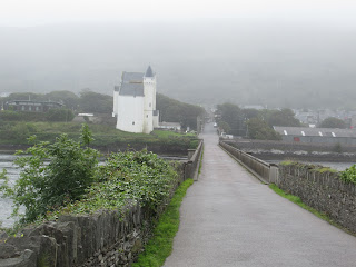
The tiny harbor on Valentia Island was just one-kilometer away by ferry to the Inveragh Peninsula also known by its more famous name as the Ring of Kerry.

From the ferry, we caught our last view of Spring Acres B&B on Valentia where we stayed for two nights and was located right across from the tiny ferry that we'd enjoyed watching come and go all day long. The location, food and room couldn't be beat as long as one liked lots of pink - on the walls, the sheets, the bathroom - just everywhere!


The ferry ride was so short, it was over almost before we knew it!


Daniel O'Connell, Ireland's most famous political leader, was born in a farmhouse near the town of Cahersiveen in 1775. He is regarded as the world founder of mass peaceful protest. The church in the town is named after him and it is the only Catholic Church in the world named after a lay person!

When we'd driven the southern part of the Ring of Kerry several days earlier, we'd spent some time at Staigue Fort, one of the three largest and best preserved prehistoric ring forts in all of Ireland. The other two were just 200 yards apart just north of Cahersiveen so we detoured to see them. Even though it was a bit dreary, we still had a very pleasant walk to the Lecanabuile Stone Fort passing some sheep farms. The name of the fort was Gaelic and meant "the slope of the Booley or summer cow pasture."


I felt like we were on an expedition and had come across something new and terribly exciting as there was no one else around and we could just wander around the walls at will!


There is debate as to why they were built but most experts believe they were constructed by people escaping from clan conflict. Valuable cattle may have been stored inside to keep them from ancient rustlers according to travel writer Rick Steves. Or perhaps the round design may have been used as a sort of amphitheater for important meetings or rituals.

Inside were the remains of a round house, the only one of several to survive and attached to it a later square house. Excavations inside the fort discovered iron knives, pins and bone hair-combs as well as mill stones for grinding flour.


Through the morning mist we could pick out Cahergall Stone Fort, the last of the ring forts we'd be seeing.


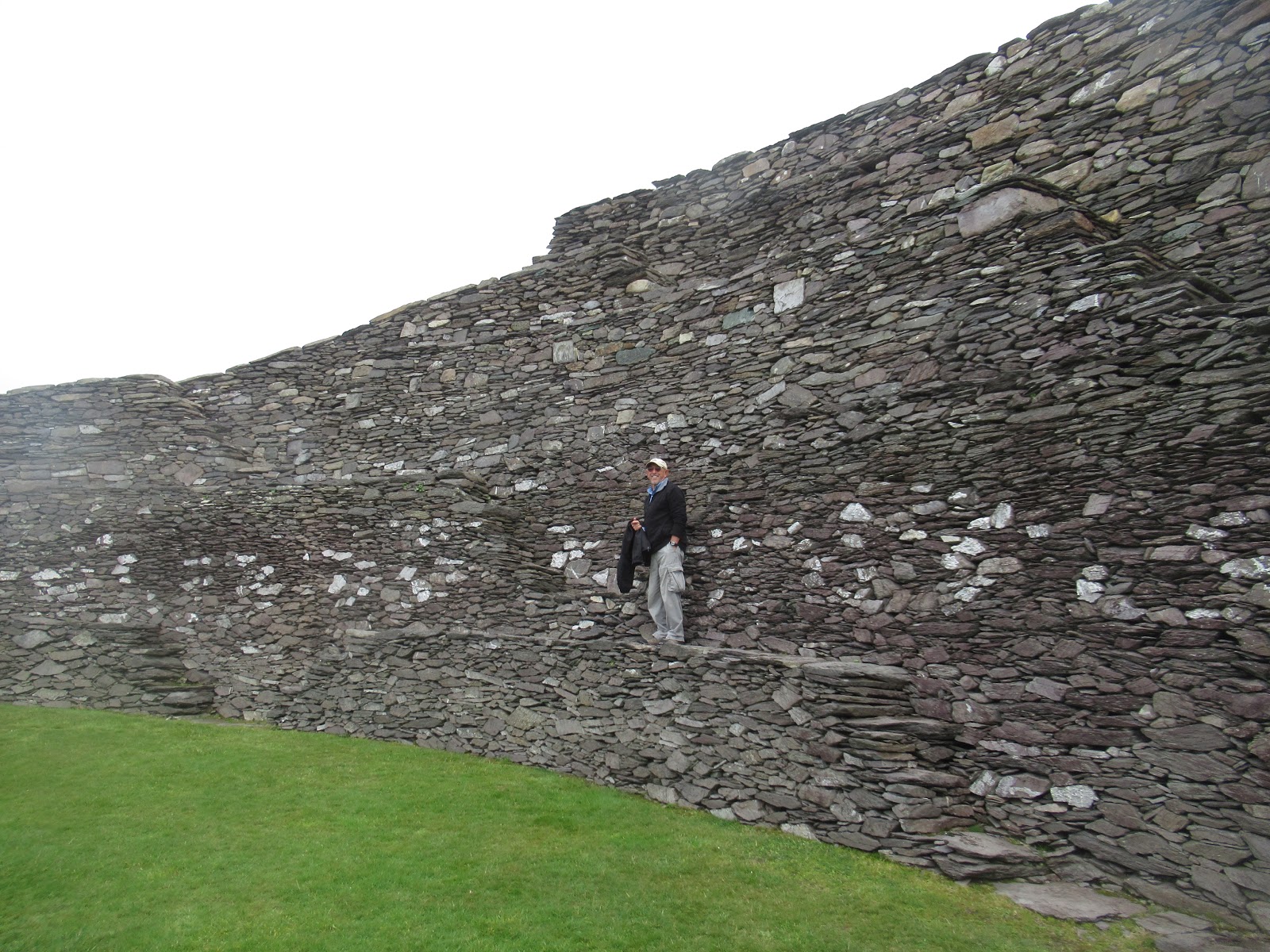
Steven was like a mountain goat climbing the steps, never faltering or wavering on the rock steps! Me, on the other hand, not so much, but it was fun clambering on the rocks imagining who might have lived at each of the forts so long ago.


Even though it was overcast, the views over the countryside from atop the fort were still striking.


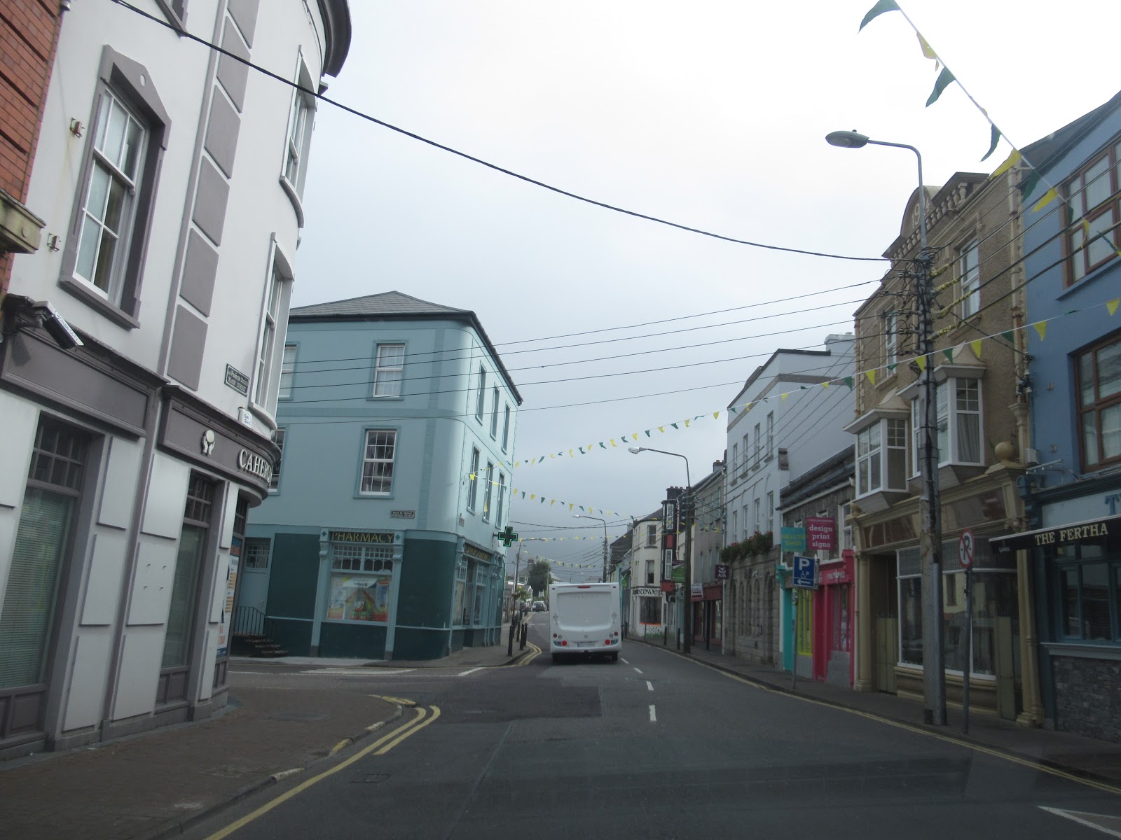
From the forts we continued on the northern part of the Ring of Kerry drive passing the Old Barracks in Cahersiveen toward the head of Dingle Bay with the town of Dingle our eventual destination that afternoon.


I had the wonderful if harebrained idea as the navigator to head us toward Rossbeigh Strand at the bottom of a long and windy road, not realizing of course it would be quite this narrow as we descended from the hills all the way to the strand or beach!

Thank goodness the view toward the beach made up for the scary road to get there!


Phew - Steven was still smiling after making it down safely through the hills to the beach! One of the luxuries of having a full month driving through Ireland where there is so much to see even in such a relatively small island, is being able to throw out the plan and "take the road less traveled" as we did on this occasion.

We wandered along the beach which was full of the smoothest stones I've ever seen in my life. I couldn't resist picking some up to check if they were really as smooth as a baby's bottom as they had no rough edges at all. Thank goodness they were so soft because they also were the parking lot!


Some people had made rock cairns, possibly in memory of those gone before them.


Some brave souls were even swimming!

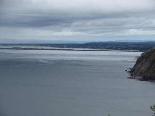
Back on the Ring, we continued driving along the Wild Atlantic Way in County Kerry still towards Dingle but stopping at the Muingaphuca Lookout for these spectacular views. I think this may have been the end of the Ring of Kerry but wasn't sure where it ended and the next scenic drive started.


Not too much further along, at the beginning of the Dingle Peninsula, was Inch Strand which meant another beach. I know it wasn't really beach weather but we opted to stop anyway as we were in no rush to get to Dingle. It was not the day to go surfing even though the cost was only five euros rental per hour for a board and wet suit!

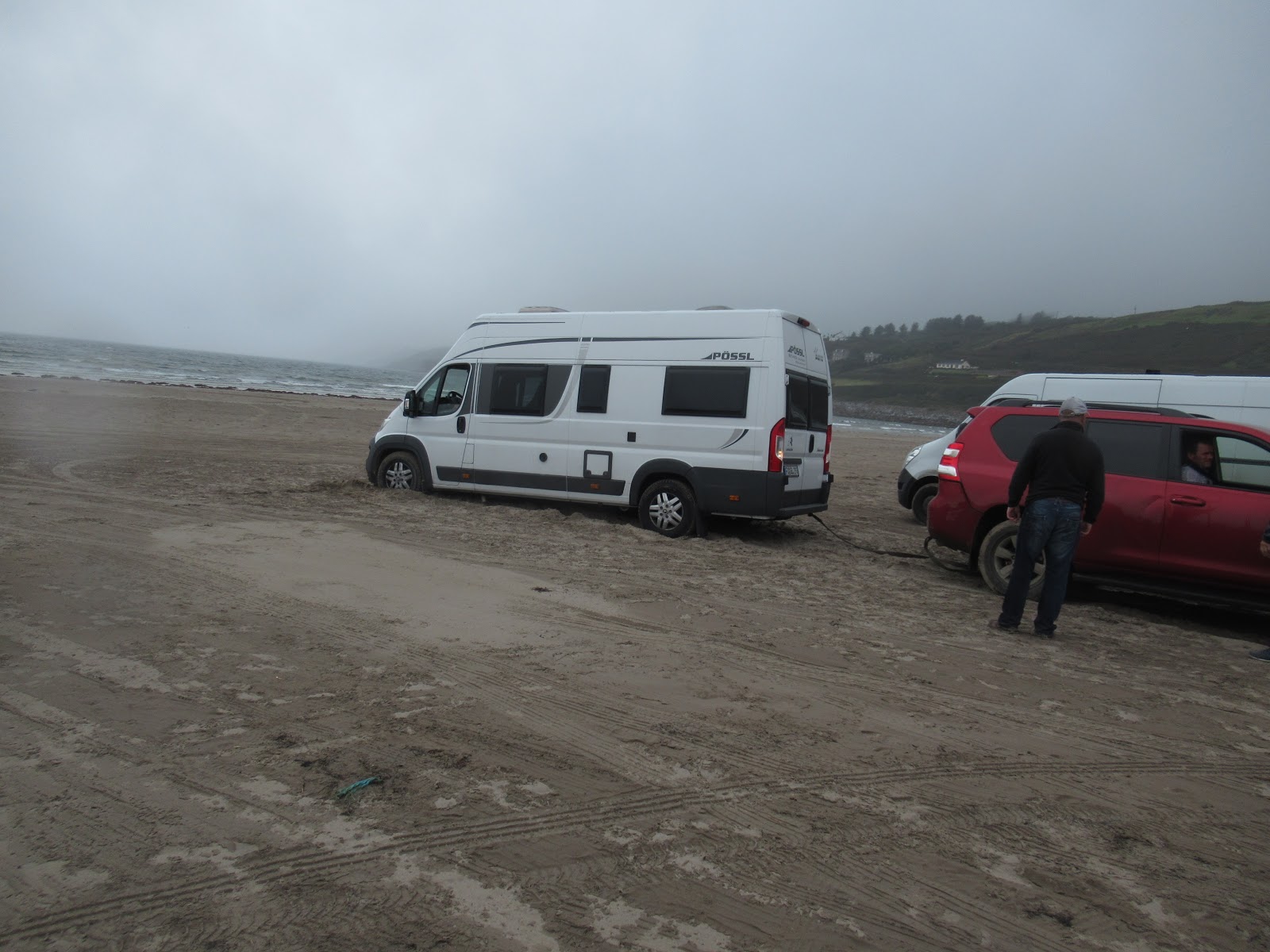
We felt badly for these people who'd chosen to park on the beach only to get stuck in the wet sand. Luckily, some people had stopped to help.
Inch Strand, like some of the other beaches we'd seen in Ireland, was a really long beach so it was a nice place to get out and stretch our legs for a bit.


What a slow business renting out surfboards must be at this time of the year in southwestern Ireland.

This sign was on the side of an ice cream shop cum restaurant cum souvenir store!


Playboy of the Western World was also filmed on Inch Beach the following year.

We couldn't resist sharing this Iceberger treat!

Three miles southwest of Dingle were the remains of Minard Castle, the largest fortress on the Dingle peninsula. Built by the Knights of Kerry in 1551, it was destroyed in 1650 by Oliver Cromwell's troops.

Because of the extensive damage, it wasn't safe to get any closer to it than this. We had hoped to catch a glimpse of a scallop in the doorway that was the symbol of St. James but weren't able to. Medieval pilgrims would stop here before visiting his tomb at Santiago de Compostela in northern Spain.

Just a few yards away, though, was the sign for the Kerry Camino, a similar walk to the more well-known religious treks in Spain and Portugal.

Next to the fortress was a wee Iron Age 'fairy fort' that has been untouched from about 500 BC as locals thought it unlucky to remove stones from these ring forts so they remain undisturbed all over Ireland!

Fluttering in the breeze were small pieces of cloth attached to bushes around the fairy fort. They may have represented prayers as is common with Buddhist practices.


Behind Minard Castle was Storm Beach where sandstone boulders had fallen from the nearby cliffs. The boulders, eroded into cigar-shaped rocks by wave and tidal action, had often been carried off by pre-Christian Celts and carved into ogham stones or monuments with linear writing.


As we continued west toward Dingle, I was very taken by the beauty of the countryside where it looked like a patchwork quilt of farms being separated by hedges!


Next post: Charming and colorful Dingle!
Posted on September 28th, 2019, from near Glasgow, Scotland, one of the aha cities as you will see when I get around to writing about our fun day here.
I loved the "fairy house" and marvelled at the resilience of the stone walls built without mortar over 2 thousand years ago. xo
ReplyDelete