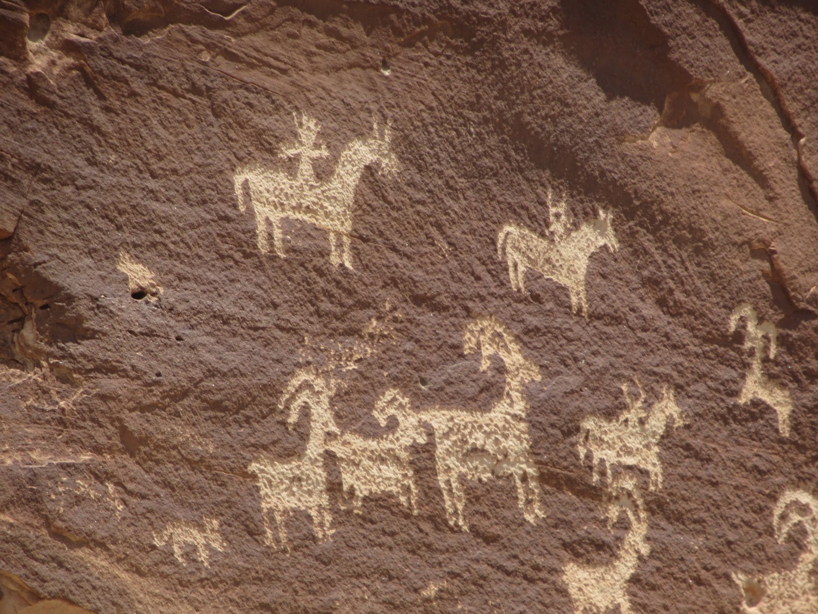
After driving such a long distance the previous day from Flagstaff to the western portion of the Grand Canyon's South Rim, and then all the way northeast through the wonderfully scenic Monument Valley to Bluff, Utah, we didn't want to hop right back in the car right away. There's sure not much to see or do in tiny Bluff but, if you're ever in southeast Utah, make sure to stop at the nearby Sand Island Petroglyphs. They were easily accessible to the small town and without any hiking into the back country.


The hundred-yard long sandstone cliff had hundreds of pecked and carved images on it that have been estimated to be between 300 and 3,000 years old. The rock art site is a place of importance to Anasazi Native Americans. The striking petroglyphs included many types of animals, geometric patterns, numerous Kokopelli and human figures.


The Twin Rocks Cafe and Gallery in Bluff fit the bill for both a yummy breakfast and, very surprisingly,being able to see the greatest collection of Native American weavings that were worthy of a museum.


In fact, collectors come from around the world to what looked like a nothing of a place in tiny Bluff to buy work created by local master artists. The shop has even donated several works to the Smithsonian. I think the owner told us it was Eric Clapton's manager that has bought lots of the silver bolo necklaces to give out as gifts as he regarded them as of such high quality.


Whenever Steven and I have a chance to drive through southeastern Utah, I am struck anew by the richness of the colors everywhere we look. We were driving toward Moab, the adventure capital of the state, located close to its border with our state of Colorado.


On our way north, we detoured to Goosenecks State Park which was a new place for us. Geologists must love this place as it is apparently one of the most impressive examples of an 'entrenched river meander' anywhere in North America. It was remarkable seeing how the San Juan River had twisted and turned 1,000 feet below the overlook and exposed 300-million years of geologic activity!

A bit of background of this amazing sight: Millions of years ago, the land here was relatively flat and the San Juan River meandered on its course. When a period of uplift occurred on the Colorado Plateau, the land rose and the river flowed faster while still following its meandering course. The river cut into the land, eventually creating the impressive entrenched meanders seen at Goosenecks State Park.

It was one of the more unusual geographical formations I've seen. It's times like these Steven and I pinch ourselves and count our lucky stars we can still travel and discover more of this intriguing world that has so much to reveal to us.

There were a few steps down to another vantage point so I held my breath and walked very slowly as I was nervous at being so high up and with nothing to hold onto.


After the park detour, there were more wonderful vistas up the dirt Valley of the Gods Road.


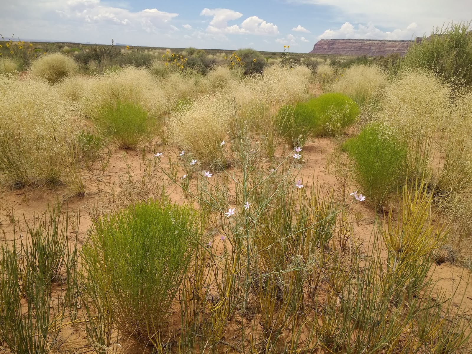
Steven was incredibly patient as I repeatedly asked him to stop the car so I could hurry and take photos of the fabulous flowers that were blooming in the otherwise arid desert. I know it wasn't easy for him either as he was concerned about pulling to the side of the dry, dusty road and possibly getting the wheels caught in the soft sand.


I made sure to stay well clear of these prickly cacti!


When we come across scenes like these, I kept thinking of what we so often miss when we whiz by at 60 or more miles per hour on interstates hurrying to get to the next place, the next store, etc.

Hold onto your seat belts!


Muley Point:


This long and winding dirt road took us to Mokee Point. There was barely a soul on the roads that day so we were relieved we had no breakdown as we drove toward the mesa.


These yellow flowers were our constant companion as we climbed to the top.

The steep road hugged the cliffs with only a few inches on either side. I was the lucky one as I was on the inside edge so didn't have scary views way down below to contend with.


We were able to get out and stretch our legs once we reached the top of Mokee Point This big outcrop had hung out over the side of the road as we approached the summit.

This was the road we'd followed to the top.

We drove along Utah State 95 where there more phenomenal rock formations en route to the bigger town of Blanding. From there, the gorgeous drive heads east to the town of Hanksville to the northwest. Between those towns was a land of changing scenery that is among the most striking in the entire US in my opinion.


We spent quite a bit of time next driving around the spectacular Natural Bridges National Monument, located about 50 miles northwest of the Four Corners area of southeast Utah. The bridges were 'discovered' in 1883 by prospector Cass Hite who was in search of gold. Instead he found three magnificent natural bridges water had carved from stone. It was declared the state's first national monument by President Theodore Roosevelt in 1908.
Wondering what the differences are between natural bridges, windows and arches? We did, too, and and found out they are all essentially the same - openings in rocks created primarily by the erosive forces of water. Bridges are formed in rock by the action of flowing water and are often found in canyons. Arches are formed mainly by other erosion forces - like frost and seeping moisture - that also enlarge natural bridges once stream erosion formed them. Windows are small openings in thin walls of rock that are not uniformly shaped like arches are. However, the same erosive forces create both windows and arches. Flowing water was required to carve a hole through a rock wall to form a bridge while an arch is freestanding and doesn't span a water course. More on arches when I post about our next day's visit to Arches National Park!
After visiting the park's information center, we followed the 9-mile long scenic loop Bridge View Drive. The world's second highest natural bridge, Sipapu Bridge, was named from a Native American Hopi name meaning 'place of emergence' or the entryway by which the Hopi believed their ancestors came into this world. Our hike to the bridge:


The stones were the trail. I just hoped nobody would move them!

Our hike down to these views of the bridge were worth it, don't you think?!


I was glad of the chance to rest once we reached the overlook!


The Anasazi occupied the Natural Bridges area from approximately 1 AD to 1300 AD. Horse Collar Ruin lay in one of the many shelters on Cedar Mesa the Anasazi used as habitation sites.


Thank goodness there were no electrical storms to worry about when we were at Natural Bridges at the end of June!


The hike to Horse Collar was quite steep and would have been very dangerous if it had been wet.


Once we reached the Horse Collar Ruin Overlook overlook, we looked across the canyon and down to the cluster of structures below. The ruin’s namesake was two doorways in the shape of horse collars.

Park officials believed they were built by ancestral Puebloans who left the area more than 700 years ago. But they didn’t know why the structures were so perfectly round, nor why didn’t their builders use the back of the alcove as a wall and save themselves a great deal of work.

Other views from the same overlook:


Next was a strenuous hike down a short, paved trail to Kachina Bridge but every step was worth it for the excellent view of another natural bridge. It was named for the rock art symbols that resembled symbols commonly used on dolls of the same name.
Another hike began!


Owachomo Bridge was the easiest of three bridges to view from underneath but there were stretches of uneven rock and steps so we had to mind our footing even though we decided not to go all the way down.


Owachomo is a Hopi word meaning 'rock mound' and derives from the beehive-shaped mound on its east side. The bridge was described as being 'old' but I don't know why. Doesn't the arch of the bridge look particularly delicate? This was my favorite one and shot of the monument.

If you have a chance to come to this part of Utah, I can't help but think you'd also be very taken by the marvelous vistas and hikes of all lengths available at Natural Bridges.

This solitary 200 ft-high column of sandstone near Monticello was called Church Rock.

Wilson Arch, known as entrada sandstone, was named after Joe Wilson, a local pioneer who had a cabin nearby in Dry Valley.


As we drove closer to Moab further north where we spent that night, the colors and formations yet again took my breath away.


Steven and I love to travel the world yet the beauty almost in our own backyard is so, so hard to beat.

Next post: Our last day on the road on the trip that began in mid May and took us down to the Florida Panhandle was spent at Arches National Park, just a few hours from home and a favorite for Coloradans.
Posted on September 5th, 2019, from Kenmare on Ireland's southern coast.
Loved the photo of Annie with a Natural Bridge in the background. Looks professional!!! Janina
ReplyDelete