I am simultaneously finishing a travel blog about the fantastic 4.5 month long trip Steven and I took last fall to Armenia, Georgia, Azerbaijan, and much of Central Asia before our final six weeks in Spain and Portugal and a few days in the Netherlands. If you're interested in checking that exciting adventure out, here's the link:
www.bergersadventures6.blogspot.com
My apologies in advance for the different font and the weird spacing in many parts of this post but they are beyond my control and due, I'm sure, to my phone's 'hotspot' providing internet here at our cabin in the state park. Sometimes it works but other times, not so much!
After exploring the section of the Great Ocean Road (GOR) from Apollo Bay to Lavers Hill and then detouring to the Otway Fly with its whimsical miniature tree houses for fairies and elves, we hit the coast again for what had to be the most spellbinding rock formations along the GOR called the Twelve Apostles Coast.


After leaving the rainy Otway region, the sun finally made an appearance again, much to our delight.


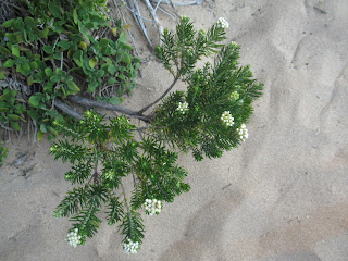
On the way back to the parking lot, we looked closely in the brush in the hope of spotting Wallabies, animals that are a smaller version of kangaroos, that shelter there during the day eating grass, fungi and shrubs and move around at night. We were out of luck, though.

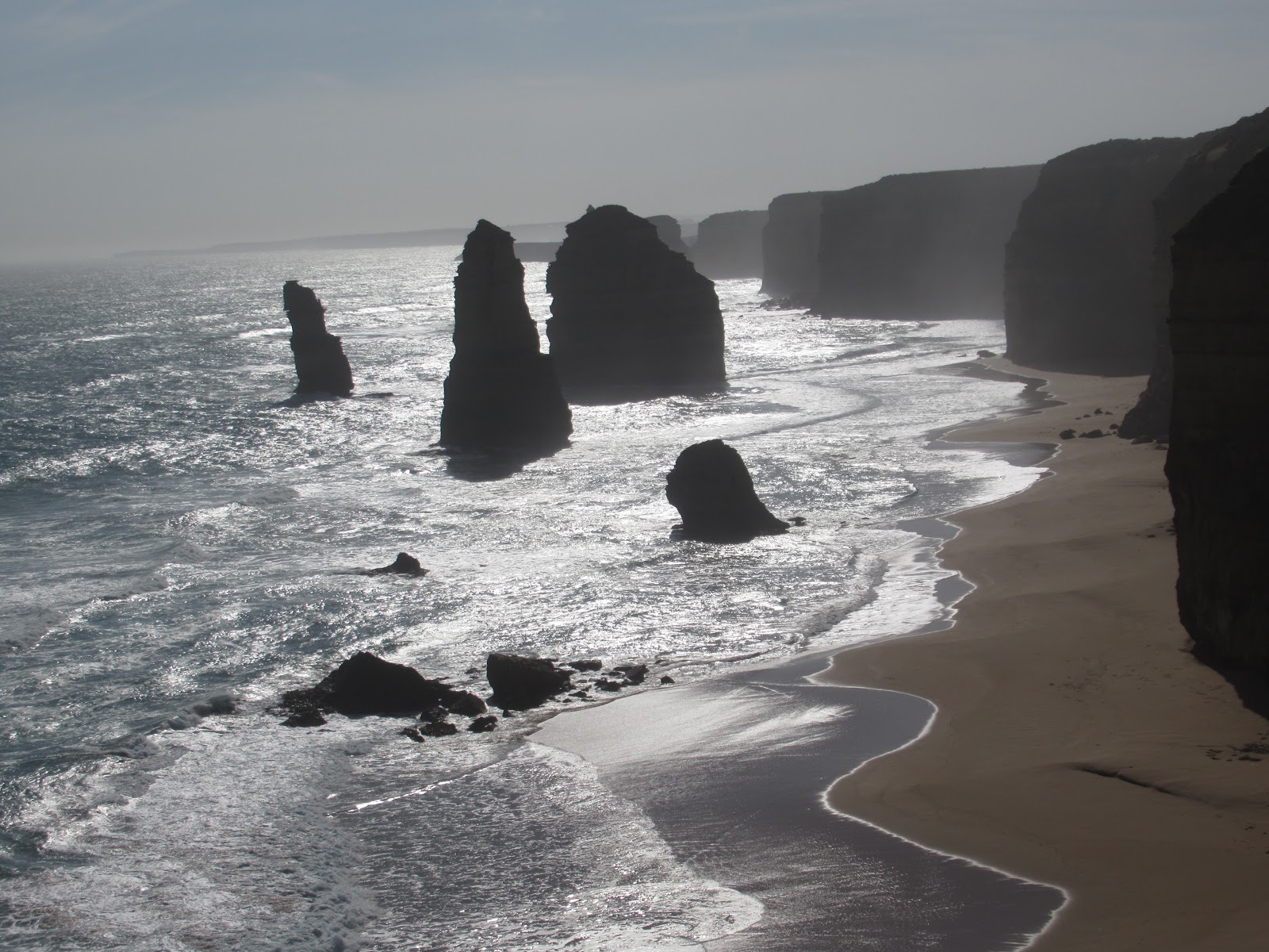
A few hundred feet along the road was the mammoth parking lot for the Twelve Apostles themselves. The towering 230-foot-high limestone cliffs were one of the most impressive and anticipated views of the Great Ocean Road for all tourists and part of Port Campbell National Park.


The marine park was an underwater world with more species than the world above it. Beneath the wild surf and power of the southern ocean was a rich marine world of outstanding color and diversity. The waterline was marked by extensive kelp forests and, I read, below were dazzling sponges, lace corals and colorful jewel anemones with rock lobsters seeking protection among them.


Although sad to leave the fantastic Apostles at 5:30, we didn't mind bidding adios to the masses of people as there were more at the Apostles than anywhere we'd seen along the Great Ocean Road. We stopped just a bit later at The Arch where there was ominously a sign not to walk, sunbathe or play under the cliffs as they might collapse without notice! Yikes, that was scary.

The Arch was another remarkable rock formation which will eventually be eroded, leaving the seaward section stranded as a rock tower like the stacks of the Twelve Apostles. I was glad we had made the decision not to walk down all 300 of Gibson's Steps and save our time and energy to see The Arch instead.


The photo clearly shows how precarious the cliffs were if any part of them were to crumble.


I can't say I blamed Diane who said she'd had enough of rock formations by then and longish walks to see them so she stayed by the car while I walked down to the viewing platform overlooking The Grotto and the rugged coastline.


I read that water from a swampy depression percolated through the 10-20 million-year-old limestone of the escarpment here. Weak acids in the water slowly dissolved the limestone forming a depression or 'sinkhole' and eventually hollowing out the Grotto.
Sinkholes can vary in size from less than three feet to almost a thousand feet both in diameter and depth and are found worldwide.


Rust colored pebbles scattered near the top of the limestone were a product of the same swamp. Known as 'buckshot,' they were formed when magnetic iron-rich particles were drawn together in the still waters at the bottom of the swamp.


Next post: Back to Melbourne for our only chance to see a few of the city's attractions before leaving for Tasmania.
Posted on May 31st, 2019, from Grayton Beach State Park, Florida, our favorite place in the US apart from our home in Denver!
www.bergersadventures6.blogspot.com
My apologies in advance for the different font and the weird spacing in many parts of this post but they are beyond my control and due, I'm sure, to my phone's 'hotspot' providing internet here at our cabin in the state park. Sometimes it works but other times, not so much!
After exploring the section of the Great Ocean Road (GOR) from Apollo Bay to Lavers Hill and then detouring to the Otway Fly with its whimsical miniature tree houses for fairies and elves, we hit the coast again for what had to be the most spellbinding rock formations along the GOR called the Twelve Apostles Coast.

Yet another sign attesting to the many Asian tourists driving along the very popular GOR! We saw swaths of land where trees had been cut down, indicating the logging industry was still thriving as it had since European settlers first came to the state of Victoria.


Located a few miles east of Port Campbell, the Twelve Apostles Marine National Park was Victoria's second largest marine national park which covered about 18,500 acres along almost eleven miles of coastline.

We stopped at Gibson's Steps, which had originally been carved by the first owner of a local homestead. Since concreted, they descended by almost 300 feet to Gibson Beach, an area popular with both fishermen and walkers.

There were frequent warning signs advising people of snakes and to stay on the walkways because of the unstable cliffs. That was all it took for us not to veer off the path!

We didn't walk all the way down because it was getting late and we had several places a little further on where there we wanted to spend more time. However, we reached far enough to catch our first sight of one of the spectacular Twelve Apostles, a sight we'd been looking forward to glimpsing since leaving Melbourne. Views of the other Apostles were blocked by the massive limestone cliffs.


A few hundred feet along the road was the mammoth parking lot for the Twelve Apostles themselves. The towering 230-foot-high limestone cliffs were one of the most impressive and anticipated views of the Great Ocean Road for all tourists and part of Port Campbell National Park.
The views wherever we looked were just magnificent!

The stormy southern ocean and blasting winds gradually eroded the softer limestone, forming caves in the cliffs. The caves eventually became arches and when they collapsed, 'rock stacks' up to about 150 feet were left isolated from the mainland. These rock stacks were the Apostles.


Because of the late afternoon sun, we couldn't see the Apostles very easily but when we looked behind us, we could see two of them beautifully.


We'd hoped to see the Twelve Apostles at sunset when we'd read the rocky pillars 'were washed by warm colors' but we were too beat by the long day we'd had to return and take advantage of the gorgeous sunset colors.

I was glad to notice a sign confirming we shouldn't be alarmed if we couldn't actually spot 'twelve' Apostles as wind, rain and high-energy waves of the southern ocean continued to carve these iconic old 'Apostles' so that they will eventually disappear. New islands are formed as they emerge from the coastal cliffs. It didn't sound like much but they erode and retreat about three quarters of an inch a year.
Early explorers in the 19th century sailed by and called this area as 'Sow and the Piglets!' The name changed around the 1920s when more tourists began visiting the area. The Twelve Apostles certainly sounded like a great marketing decision instead of sow and piglets, don't you think?!!


The Arch was another remarkable rock formation which will eventually be eroded, leaving the seaward section stranded as a rock tower like the stacks of the Twelve Apostles. I was glad we had made the decision not to walk down all 300 of Gibson's Steps and save our time and energy to see The Arch instead.


It was so much fun walking in the small cove and seeing the mighty waves crash against the rocks.


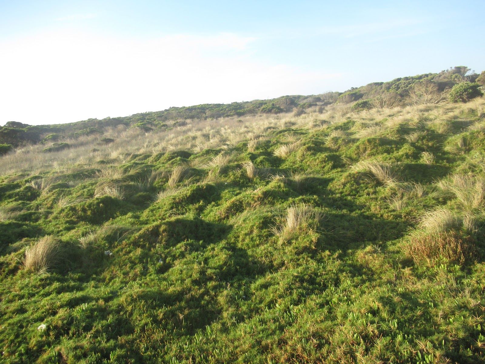
The national marine park includes some of Victoria's most spectacular scenery. Breeding colonies of seabirds regularly roost on the rick stacks and islands withing the park. There were also colonies of Little Penguins but they were only visible at dusk when the birds return from a day of hunting. Sadly, Janina, that meant we didn't see them so I could take any photos for you.


Sinkholes can vary in size from less than three feet to almost a thousand feet both in diameter and depth and are found worldwide.


In January, 1990, the main arch connecting London Bridge to the mainland cracked and fell into the sea. Fortunately no one was injured but two tourists were marooned on the island until they were rescued two hours later by helicopter. It had been called London Bridge due to the close resemblance of its double arches to the actual bridge in England. When Steven and I are in London in October, I hope we'll have time to see the original London Bridge.
The name changed to London Arch after the first arch collapsed.

As the coastline was particularly beautiful and rugged and historically treacherous for passing ships, this area was called the Shipwreck Coast. Its most celebrated tale was the story of the Loch Ard, a three masted square-rigged ship that weighed 1,693 tons. The ship's master incorrectly estimated his ship's position as further offshore when he expected to sight Cape Otway but instead unexpectedly came across breakers, cliffs and rocky islands when the night mist cleared.
Despite frantic efforts by the crew to turn the ship around, they were too late and the ship smashed into a reef, causing it to sink quickly and 52 lives were lost with just two survivors. Several days
after the Loch Ard sank, a wooden crate was found that contained a life-sized porcelain peacock that was intended to be displayed at the 1880 International Exhibition in Melbourne. The wreck of the Loch Ard now lies in about 90 feet of water and is a favorite spot for divers. 
If I could ever describe a perfect day along the Great Ocean Road, this would be it. Although it felt like days ago already, Diane and I'd started the day in the pretty fishing town of Apollo Bay, continued on to Maits Rest for a wonderful meander through the rainforest, then the thrilling elevated Otway Fly and its ever so charming tree houses complete with fairies and elves, oh my, before reaching the stupendous rock formations at the end of the day.

Posted on May 31st, 2019, from Grayton Beach State Park, Florida, our favorite place in the US apart from our home in Denver!
No comments:
Post a Comment