I am simultaneously finishing a travel blog about the fantastic 4.5 month long trip Steven and I took last fall to Armenia, Georgia, Azerbaijan, and much of Central Asia before our final six weeks in Spain and Portugal and a few days in the Netherlands. If you're interested in checking that exciting adventure out, here's the link:
www.bergersadventures6.blogspot.com


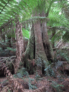
From Apollo Bay we drove along the GOR through part of the national park, stopping first at Maits Rest Rainforest Walk. It turned out to be a delightful walk that meandered across tree-fern gullies and around the moss-covered roots of ancient rainforest trees.

A sign indicated that rainforests are home to more than half of the world's plant and animal species. This rainforest had evolved over millions of years and, for tens of thousands of years, local aboriginal people, collectively known as Maar, had an ongoing spiritual connection with this area that continues to provide important cultural and historic links.


Some of the walk's ancient Myrtle Beech trees were estimated to be more than 2,000 years old. With their woven canopies they formed a shelter protecting the plants beneath. The ferns, lichens and mosses that grew on the trees are called epiphtyes, sometimes referred to "passengers hitching a free ride reaching out for sunlight and rain."


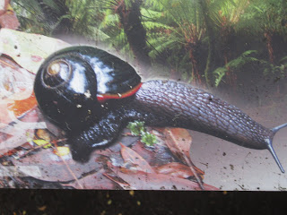
Diane and I looked carefully on the forest floor for the Otway Black Snail, a rare carnivorous snail that is only found here in the Otways where it feeds on insects, other snails and worms. We were out of luck that day, though. This photo was from a sign.
We read that Mountain Ash trees in this forest began life as a seed the size of a grain of sand and then can grow over 300 feet tall which make them the tallest flowering plants in the world.


Ribbons of bark are constantly shed from their giant trunks to help enrich the forest floor and soils. This bark is part of the 40 tons of organic litter that accumulates per hectare per year in these forests! The bark was totally absent from the upper reaches of the trees.


The tree formations on the drive to the lighthouse looked otherworldly.

The Cape Otway Lighthouse, built in 1848, was the oldest surviving lighthouse on mainland Australia as well as being the second most southerly point on the mainland and also one of the wettest parts in the state of Victoria. From its Telegraph Station there was a 240 mile-long underwater cable link with the island of Tasmania that was laid in 1859. When the telegraph cable failed after two years because of weather conditions, the building was then used as a signal station, using signal flags to communicate with ships and then telegraph messages onwards.


Before the days of radio communication, signal flags were used to communicate with ships passing Cape Otway en route for Melbourne, Sydney and Brisbane. Each flag represented a single letter of the alphabet or had a special meaning. The flags were flown from the large flagstaff in front of the station. In the 19th century, Cape Otway could ask for information such as the name of the ship, its ports of departure and destination, and, if it were an emigrant ship, how many passengers were on it, and how many births or deaths had occurred during the voyage.

Especially important, the ships could be asked if there were any infections such as cholera, typhus or scarlet fever on board which meant the ship and passengers would have to be quarantined. In the 19th century, a ship flying a yellow flag meant it was carrying disease and would have to be quarantined in reaching port. Now though, flying a yellow flag means exactly the opposite - that the ship was free from inspection.

The signalman would also ask the captain for the 'latest' news from Europe, North America and Asia and, in return, would give the latest Australian news and information about other ships passing the Cape. A passenger could also have a personal message sent from the ship and transmitted onwards from Cape Otway. The information would then be telegraphed onwards to Melbourne and beyond taking just four minutes to reach Melbourne from Cape Otway.

Telegraphy revolutionized communication and was the equivalent of the internet of its day. It allowed for a faster method of communication and information exchange - it 'shrank the world.' With the advent of the telegraph, information that had previously taken days and months to send and receive via horse and ship, took just minutes and hours.


By 1861, the office became increasingly important as the link between Australia and ships arriving from overseas. This was especially the case for those ships carrying mail. The arrival of these ships was eagerly anticipated, for they carried mail for Victoria and beyond. For example, the Nubia arrived on May 31st, 1872, carrying 39,000 letters, 4,000 packages and 88,000 newspapers.

In 1890, the telegraph station sent 1,560 messages and 2,427 letters but received only £7 in revenue. Not surprisingly, Cape Otway Telegraph Station was never profitable. Its value lay in providing the link with shipping arriving off the coast which was why it continued to be used until 1902.
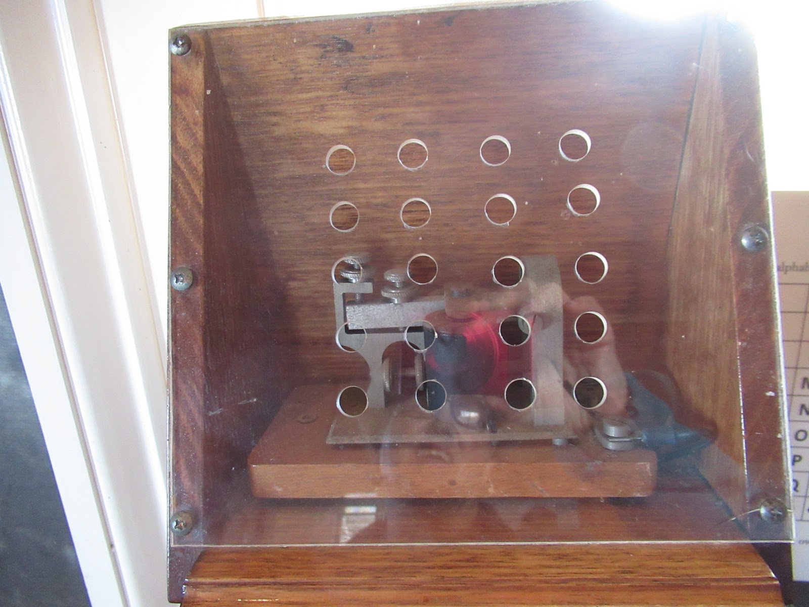
To communicate with shipping, they used signal flags, semaphore and electric Aldis lamps. As there was no electricity at the Telegraph Station until 1942, the signalmen had to pedal bicycles in order to power the dynamo and generate electricity!

The Australian Navy used the property as a signal station during WW II until late 1944.


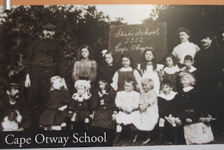
Since 1848 children have always played a part of life at Cape Otway Lighthouse. Initially they were home schooled until 1883 when an official state school was opened in the Telegraph Station, following a petition signed by those living at the Light Station because there were 16 children of school age and another four eligible for kindergarten in a few months' time.


The curved roof provided support for the 4.5 ton light source located in the Lantern Room. The stairs were single blocks locked into each other stair and 'keyed' into the circular structure.


Lavers Hill was perched on the highest point of the GOR and at 470 meters above sea level offers spectacular views. When this portion of the GOR was finally paved in 1984, the town was revitalized as a gateway for tourists to the coast.

www.bergersadventures6.blogspot.com
The flowering bushes by our hotel room in the small town of Apollo Bay along the Great Ocean Road (GOR) were simply gorgeous.


Before leaving Denver, I'd read a post by a fellow blogger who'd recommended a neat breakfast place called Hello Coffee in Apollo Bay's industrial area so we decided to give a try.


Spending time in Apollo Bay that morning was two fold: to see some of the sights as we knew not to leave until after 8 to avoid animals on the road as 'kangaroos had no road sense!" Our journey that day would only be 200 miles long but we were sure that with so much to see, we would likely not reach our destination until dinner time!

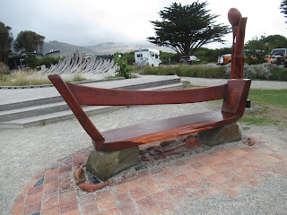
On the town's main street was a recreation of the state's icons along the Great Ocean Road that we were so looking forward to seeing that day.


Apollo Bay began life as a whaling station and was named after Captain Loutit's ship, Apollo. Though its primary local industry is fishing, tourism is important as the town is a jumping off point for exploring the Great Otway National Park. The town port before we began our exploration of more sights along the GOR:


The raised wooden boardwalk deep into the ancient rainforest helped protect the fragile ecosystem but provided marvelous forest views. The walk was named after the district's forestry officer Maitland Bryan who rested his horse near this location on his regular patrol from around the beginning of WW I and for many years afterwards.


When these trees eventually die and fall back to the earth, they will open the forest to sunlight which will therefore promote new growth and thus ensure the cycle of the rainforest continues.

The walking path was only supposed to be about 45 minutes long but Diane and I both stopped so often to take pictures of the amazing ferns and trees, it took a whole lot longer!


I think this was the only shaft of sunlight that was able to pierce through the canopy of trees to the path below!


A little further on was Lighthouse Road, a beautiful 13-mile long forested road with towering trees that were home to a sizeable population of koalas. We peered in the trees but unfortunately didn't see any of the furry animals.


The Australian Navy used the property as a signal station during WW II until late 1944.

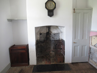
The Station's living quarters consisted of three bedrooms, a kitchen, pantry and parlor. The Telegraph Station manager was expected to live there with his family, including up to nine children! The assistant telegraph operator was also expected to lodge with them. Originally there was no bathroom but, over time, additions and alterations were attached to the building including a wash house.

Since 1848 children have always played a part of life at Cape Otway Lighthouse. Initially they were home schooled until 1883 when an official state school was opened in the Telegraph Station, following a petition signed by those living at the Light Station because there were 16 children of school age and another four eligible for kindergarten in a few months' time.


The flagstaff was located just outside the Telegraph Station. I had no idea that signal flags were still used today, did you?

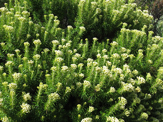
The walk to the lighthouse on the Cape took us along a path filled with low lying shrubs, some of which had pretty flowers.


By the 1850s a number of weather stations were established in Victoria, including at Cape Otway, to improve understanding and forecasting of the weather in order to reduce deaths at sea. The Telegraph Station would then telegraph the reports to Melbourne. The last manually obtained weather reports at Cape Otway were taken in 2015! Today it is fully automated, with updates every thirty minutes.

It was amazing to read that once it was decided to build a lighthouse at Cape Otway, it took the crew just one hour to survey the proposed location for it!


The lighthouse was built by more than 40 stonemasons with neither mortar or cement. As each stone on the wall was hand carved, each one had its own style just like a signalman.


A guide in the Lantern Room told us all lighthouses have their own signals and that the one at Cape Otway emits three flashes every eighteen seconds to warn ships coming around the headland. The lantern's lenses were designed by French physicist Augustin-Jean Fresnel.

It was so, so windy walking around the top of the lighthouse I had to take my glasses off for fear of losing them altogether.


The road headed inland from the lighthouse toward Lavers Hill where it was a little strange seeing so many cows and farmland along the GOR before we learned more about the area's history. Early settlers decimated much of the Otways when tree cutting began in the 1850s, mainly along the coast from where the logs were taken by ship and later by rail to Melbourne.

In the 1880s, a large section of the Otway ridge was opened for farming so clearing the forest became a priority. Over time, the forest recovered so that nowadays the rich volcanic soil and good rainfall produced a landscape that varies from "densely treed forests, cascading waterfalls and fern gullies to fertile lake country and rolling foothills before the countryside reaches the spectacular scenery of the coast."

Even stranger, though, was this traffic sign in Chinese, an indication of how very popular the GOR is with foreign tourists and especially Asian ones.

We stopped for few minutes at the stunning Castle Cove Lookout which was part of Great Otway National Park.


On the way to Lavers Hill, we didn't have time to stop at Melba Gully descried as "the jewel of the Otways" where glowworms and a giant 300-year-old tree with a circumference of more than 88 feet could be seen. Perhaps, Steven, if we return again to Australia, we could stop at Melba Gully!

A historical marker at the small town of Lavers Hill indicated that the GOR was built as a living memorial to the Victorians who served in WW I. When it was completed in 1932, it opened up the ocean areas to tourism and development. The road's unrivaled beauty was a lasting tribute to the memory of those who served their nation in war and the 3,000 men who built it.


Before taking on what turned out to be the simply amazing Otway Fly and the magnificent natural wonders along the Great Ocean Road that afternoon we stopped for some 'necessary' coffee and pastries before pushing on.

Next post: Being a kid again on the Otway Fly and breathtaking rock formations along the GOR!
Posted on May 25th, 2019, from Grayton Bach State Park on Florida's Panhandle after a long delay supervising renovations on the home front and then a multi-day drive down to Florida.
You had a lovely blue sky day at the lighthouse. Janina
ReplyDelete