After driving another 500 plus miles through western New Mexico and a good piece of eastern Arizona, we decided to detour north to Wupatki National Monument and Sunset Crater Volcano just 30 miles north of Flagstaff, Arizona. Flagstaff would be our stop for the next few nights as it was relatively close to the Grand Canyon where Steven and our sons would be hiking for a couple of days.

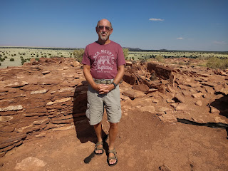


Wupatki was set aside to protect the ancient dwellings of puebloan peoples. The monument takes up 56 square miles of dry, rugged land on the Southwestern Plateau directly west of the Little Colorado River. Steven was standing on the remains of a mesa-top village. A sign indicated there are often pronghorn sheep in the area but we saw none that afternoon.


Nalakihu is a Hopi word for Lone House or House Outside the Village. The structure was given its modern name because of the mesa-top village known as the Citadel. We read that the the walls and individual stones of Nalakihu revealed an 800-year-old story when each stone was selected, hewn and placed here. Homes ranged from one-story, single-family structures to a multi-level, high rise that had about 100 rooms.

We walked the short distance to see the remains of Citadel Pueblo. The effort and skill needed to build this structure, situated on one of the highest points in this area, was mind boggling. Archaeologists estimated that builders moved about 3,200 pounds of stone, 1,000 pounds of sand and clay, and 34 gallons of water in order to build just each cubic foot of wall in the structure.

Furthermore, archaeologists estimated that the Citadel required at least 500 wooden roof beams brought in between 12-20 miles away. I could barely imagine what it must have been like to be a builder, or quarried the stone, hauled water or made the long trek to bring the roof beams. Standing on the rooftops people could have seen and been seen for miles. With such a visible presence, the Citadel must have been a commanding presence.


The environment provided materials ideal for the construction of freestanding masonry dwellings. Sandstone slabs, limestone blocks, and chunks of basalt set with a clay-based mortar contributed to make sturdy buildings that, despite weathering and vandalism, remained partially intact more than 700 years after their owners left.

The remains of masonry pueblos or villages that dotted the Wupatki landscape were the most obvious evidence of the human endeavor in this huge land. In the 1100s, puebloan people came together to build a vast farming community that may have migrated from drought-stressed areas on the Colorado Plateau to join people already living there. With the first eruption of the Sunset Crater, the agricultural potential improved because the thin ash layer absorbed precious moisture and helped prevent evaporation. A climate change also provided more rainfall during the growing season.

More people lived in this area called Wupatki Pueblo between 1100 and 1200 than ever before or since. As it was located along routes that linked large populations to the northeast and south, the villages were well suited for trade. As people, goods and ideas converged in this area, a complex society of several thousand people evolved. This particular village became the heart of a thriving community and it became a gathering place and a ceremonial center. Wasn't it remarkable that this hot and dry land supported a large farming community?

I had never seen these pale pink feathery flowers before; they were everywhere in the national monument.


The black cinders we saw covering the ground all around us remained from the eruption of nearby Sunset Crater Volcano in approximately 1180.


What an unusually shaped rock on one of the paths in the pueblo!

The reconstructed circular structure resembles a great kiva, a special room used for rituals and ceremonies. Archaeologists, though, haven't found any evidence of a roof or other floor features typical of a kiva. Perhaps the open-air community room may have served as a central gathering space.


Ball courts were common in southern Arizona from 750 to 1200 but rare in the northern part of the state. Over 200 ball courts have been found in Arizona! This reconstructed ball court was an unusual structure as ball courts in the Southwest weren't normally masonry. This one may have had multiple functions: a place where special ceremonies were held, where competitive games were played for socialization or where children played a game with a stick or ball, similar to hockey. It likely also served as a reservoir after rains. Balls found at archaeological sites containing ball courts were made of carefully shaped rock and perhaps covered with pine pitch or other material.


This blowhole - a crevice in the earth's crust that appeared to breathe - was one of several found in the Wupatki area. It was connected to an underground passage called an earthcrack which resulted from earthquake activity in the bedrock which have enlarged over time.

The Hopi, descendants of the early people who lived here, refer to the 'blowhole' as the breath of "Yaapontsa," the wind spirit. They and other American Indians attach spiritual significance to these features. It was so refreshing standing atop the blowhole and feeling the cool air!


This rock outcrop provided an almost ready-made room, initially used for household trash. Roughly five feet of debris was placed here before the first floor was laid and the space was used for a living room.


Park rangers used to live in this pueblo! Two employees lived in the two rooms above during the 1930s. They hauled water from a nearby spring but had the luxury of cooking with propane. One of the staff excavated a small adjoining storage room to house a gas fridge; commercial electricity didn't arrive until 1959. The government charged them $10 a month for rent!


From Wupatki, we headed south toward Sunset Crater Volcano that was also part of the monument. The people living just northeast of what is now Flagstaff must have been warned by tremors before debris exploded from the ground and rained down on their homes. The lava flows and erupting cinders that followed forced the farmers to vacate the rocky lands they had cultivated for 400 years. A few generations later, families returned to Wupatki and nearby Walnut Canyon to grown crops for another 100 years in the shadow of Sunset Crater. Slowly, plants and animals also returned, some specially adapting to living on the lava. Nowadays, occasional earthquakes still remind local residents that they live in a geologically active area.


Spatter cones formed when lava was forced up through an opening in the cooled surface of a lava flow.


As lava flowed from the base of Sunset Crater Volcano, it cooled and hardened into many fascinating patterns and shapes, leaving behind a bizarre landscape frozen in time. This upright section was called a squeeze-up which formed when molten lava oozed out through a crack in a solid lava shell. As the squeeze-up grew, gravity caused it to bend from its weight.

In the distance was Williams Peak on the left and San Francisco Peaks on the right. The field has been inactive since the eruption of Sunset Crater Volcano but long quiet periods have occurred prior to an eruption throughout the field's history.


We could see how purple asters and white apache plume flowers have adapted to the rugged terrain. The brightly colored plants looked radiant against the basalt.


The trees looked so lush and vibrant against what I initially thought was such a barren landscape.


We stopped briefly at Cinder Hills Overlook to look at the red-cinder covered vents. They marked a fissure where the most recent volcanic activity occurred.

Even though we'd been driving for hours and hours that day, we were so happy we'd decided to spend some time driving through Wupatki and Sunset Crater as the views were spectacular, learning about the ancient history of the puebloan people was fascinating, and the geological formations were unlike any we'd seen previously.

Next post: A few hours in Sedona with our youngest before he, Steven and our other son hike the Grand Canyon for two days.
Posted on August 25th, 2019, from Denver just hours before we fly to Ireland for a month before a couple of weeks in Wales, Scotland and London!
Have a wonderful trip in the old country (Annie especially). I look forward to reading all about it when I can. Big hugs!!
ReplyDeleteWe have Apache Plumes in our backyard landscape here in Denver. Janina
ReplyDeleteAndrew,
ReplyDeleteSteven and I have been looking forward to visiting the 'old country' for a long time so we're glad we made it over the 'pond' just yesterday. I'll be glad to see you pop in to the blog when you can.
XOXO from Dublin