I am simultaneously finishing a travel blog about the fantastic 4.5 month long trip Steven and I took last fall and early winter to Armenia, Georgia, Azerbaijan, and much of Central Asia before our final six weeks in Spain and Portugal and a few days in the Netherlands. If you're interested in checking that exciting adventure out, here's the link: www.bergersadventures6.blogspot.com


Before doing some research prior to our 3.5 week trip to both New Zealand and a very small part of Australia, I read that the island of Tasmania was about the size of West Virginia and had a population of just over half a million. My friend Diane and I arrived in the northern Tasmanian city of Launceston located n the middle of the island the day before from Melbourne. We then made our way up and over to the east coast before heading straight south to the charming town of Swansea situated halfway down on the east coast.
After arriving pretty late the last evening in Swansea and being unlucky staying in some pretty questionable accommodations prior to that, it was such a welcome sight waking up at our B&B to this pretty view and a humdinger of a breakfast. I just hoped the latter wouldn't bring on an immediate heart attack!


Needing to digest that mega breakfast before hopping in the car, Diane and I walked along the Swansea waterfront to the town's jetty which apparently was a great place for recreational sea fishing.


After seeing those foreboding skies, we figured we'd better not dally any longer! We hoped that the foul weather was just part of a weather pattern we'd become used to in southern Australia with rain and cloudy skies in the mornings and then burning off later in the day.

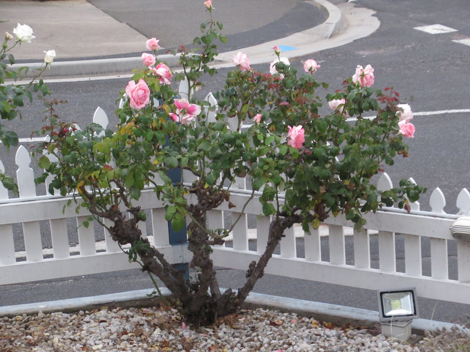
Just five miles south of town and opposite the ocean was a new vineyard. I wondered how long it would take for the vines to grow to harvest the grapes and make a drinkable wine. Anyone know the answer to that one?


Prosser Bay looked about as pretty as it gets.


Though our destination for most of the day were the sights in Tasmania National Park, we couldn't resist stopping a little further on for a while at Orford where we read a sign that indicated the original inhabitants of the area were the Tasmanian Aboriginal people from the Oyster Bay Tribe who lived a peaceful hunter-gatherer lifestyle. Following European settlement, many died from introduced diseases and were forced out of their natural homes because of conflict with settlers. Doesn't that sadly sound like a common refrain?

Maria Island National Park was a small piece of land in the middle of the bay famous for its wildlife and as a bird lovers' paradise.

From Orford, I, as the navigator, suggested to Diane we take a 'shortcut' and drive directly south along the Wielangta Forest Rd. toward the national park. It sounded like a great idea to me but the drive on the gravel road got more than a tad hairy for Diane when the forest became shrouded in fog.


I thought the scenery was gorgeous if barren but Diane was getting increasingly concerned about continuing along the almost deserted rod.

After driving for about 10 miles - or was it closer to 15, Diane?! - we spotted a sign that said we would soon come to a 16% downhill grade, so we cut our losses and turned around. The so-called shortcut I'd suggested didn't turn out to be so short after all - oops. Thank goodness Diane hadn't gotten upset and was still talking to me and that we were even able to laugh it off as it was all part of our adventure together!

Sadly, we had again seen a lot of roadkill on the gravel road including wallabies and Tasmanian Devils - more on the latter in a later post! They were way too gruesome to take any photos of as you might imagine.

Feeling a bit guilty about our detour, I treated Diane to her daily coffee fix from a food truck at the lovely, lovely Tasmanian National Park Lookout once we finally got there!


Having traveled much of the world with Steven, we have seen some amazing lookouts but it was hard right then to think of one prettier than this.

Just a few miles away by Eaglehawk Bay was the Tesselated Pavement, the isthmus that connected the Tasman Peninsula to Tasmania. Although the depressions looked distinctly man made, they were the result of a rare type of natural erosion. Occurring near sea coasts on flat rock which has broken into regular blocks, the effect is known as 'tessellated pavement' for its resemblance to Roman mosaic floors, also called tessellated pavement.

I read the pavement takes two forms. Depressions are known as either pan formations, occurring when saltwater wears away the center portion of the stones into pools. The opposite effect is known as a loaf formation, when the edges of the stone are worn away leaving a rounded crown resembling rising bread.


Tessellated pavement is extremely rare, found only in a few places on earth. The geology is not related to the effect that created the Giant’s Causeway in Northern Ireland (which Steven and I'll be making a point of stopping at in September) and Fingal’s Cave in Scotland. Those features were formed as basaltic lava cooled and fractured; tessellated pavement occurs as sedimentary rock erodes.

I was so happy seeing this really unusual geographic feature since first finding out about it when beginning to plan this trip Down Under so many months ago. It'll be fascinating to see how it compares to the Causeway half a world away.

Another pied oystercatcher, right, Suellen?

Strolling across the tessellated pavement made me think how the wonders of nature continued to amaze me.

We stopped at Eaglehawk Neck, a thin strip of sand only 100 meters wide at its narrowest and the gateway to Tasman Peninsula. The Neck was a strategic and necessary military site to guard the Peninsula when Port Arthur, further south, operated as a penal colony. The only remaining building to survive from the period of military occupation on the Neck is the Officers' Quarters. Built in 1832, the building was the oldest timber military building still standing in Australia. Today it housed a bare bones and unattended museum that depicted life on the Tasman Peninsula during the 1800's.

This rickety little house was the Officers' Quarters and the only remaining building of a substantial military station. The simple initial two-room hut was built by convict labor and more rooms, also built by convict labor, were later added. Initially built for the officer in charge and the sergeant, it later housed only the officer and his family. It later became a holiday and honeymoon cottage for military officers.

Exhibits in the museum relayed that as settlers moved inland with their flocks of sheep, more and more Aboriginal hunting lands were taken over, with no payment or hint of negotiation offered to the Aboriginal tribes. Settlers shot and killed Aborigines indiscriminately and, in retaliation, Aborigines raided huts and attacked and killed settlers. The result was war had begun by the mid 1820s.

It was difficult reading that Lt. Governor George Arthur had believed the Tasman Peninsula would make an ideal natural prison for the Tasmanian Aborigines if they could be driven from their tribal territories. Here, he thought, they could live a so called 'savage life' and pose no threat to the interest of white settlers.
A British proclamation was issued in cartoon style that was nailed on trees in an attempt to explain British law to the Aborigines. As the warring between Aborigines and settlers worsened, the British leader declared martial law against the Aborigines in settled districts. A bounty of five pounds was offered for each Aborigine adult and two pounds per child.

Arthur's superiors back in Britain stated that conciliation was the way to persuade the Aboriginal people from their land but the settlers demanded the tribes be forcibly removed. When Lt. Governor Arthur chose the latter, the Black Line was planned. That became an infamous part of Tasmania history when 4,000 military, police, convicts and settlers were employed to march across Van Diemen's Land (the original name for Tasmania), driving the Aborigines before them from the settled districts and into Tasman Peninsula "containing many thousands of acres of most unprofitable soil for Europeans, (but) is well adapted for the purpose of savage life, abounding in game" according to Arthur in 1830.


I was glad to read that there is now reconciliation, at least from the government's perspective, with the Tasmanian Aboriginal community now numbering over 8,000. Reconciliation in the form of land rights is critical for the Aboriginal people, a concern also important to the native communities in both Canada and the US. I wonder how successful the Tasmanian Aborigines will be in their campaign to have a number of significant sites and areas of land returned to them almost two hundred years since they were taken?


More of the former military settlement:

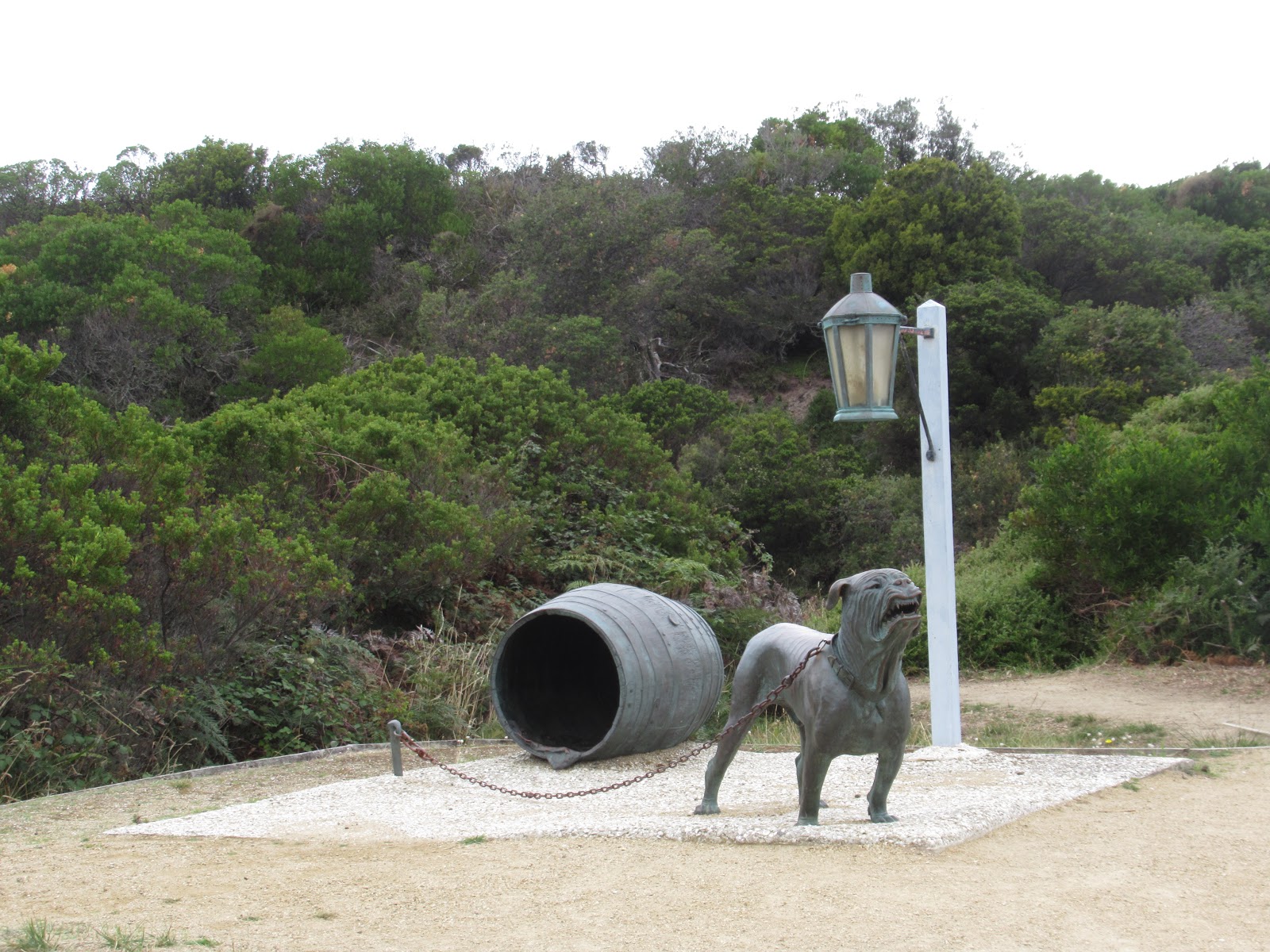
It occurred to the leaders that the only way to prevent the escape of prisoners from Port Arthur was to establish a line of lamps and dogs. A cutting was dug across the width of the dunes to form a passage from one side of the Neck to the other. The cutting, covered with white cockle shells which, with the light from lamps, illuminated the site at night, was called the Dogline.
The Dogline at Eaglehawk Neck circa 1832:

At first, nine dogs were chained along the length of the cutting which created an impenetrable, ferocious blockade. Anyone approaching Eaglehawk Neck by land or water would activate the alarm, the cordon of vicious, barking mongrels.
News of any escapes from Port Arthur was transmitted via a chain of semaphores, one of which was located on top of the dunes at Eaglehawk Neck. The system worked. Throughout its 45 years of operation, only a few prisoners succeeded in passing through the barrier. Seeing just this recreation of the infamous Dogline sent chills down my back,
What a cute addition to my collection of bathroom signs, don't you think?!

Just south of the narrow isthmus at Eaglehawk Neck, the east coast of the peninsula had several natural wonders, including Tasman's Arch and Devil's Kitchen.

Views from Fossil Bay Lookout:


Nearby, a natural bridge called the Blowhole began as a small cave chipped away by waves. The description stated the Blowhole was a former sea cave and tunnel that created a broad arch when the roof at the rear of the tunnel collapsed. The Blowhole only lived up to its name when the seas were rough and in the right direction. Then, swells enter the tunnel and sea-spray and air are blasted through the funnel, creating an explosive effect.

There was a walkway all the way around so that gave us many great angles to see it from. We were there when it was low tide. How fantastic it would be to see it actually 'blow' and capture on film!

On the way to Tasman's Arch and Devils Kitchen, Diane and I both couldn't help but smile when we drove through the small community of Doo where there were several signs containing puns about the area’s name. I considered it my 'dooty' to take pictures of several of them as I thought anyone reading this post would also find them rather amusing!


The house was called Doo Little!

I knew this was a play on Kakadu National Park in Australia's Northern Territory as Steven and I had been lucky enough to visit it several years ago.

Just minutes away we were blown away by what we saw at the Tasman's Arch Lookout: a deep hole with steep cliff walls dropping to the ocean. The forest on the far side of the hole was actually a suspended land bridge, Tasman's Arch. Below the arch, waves passed in and out between the Tasman Sea. The Arch was what was left of the roof of a large sea cave or tunnel, that was created by wave action over many thousands of years. The pressure of water and compressed air, sand, and stones acted on vertical cracks or joints in the cliff, dislodging slabs and boulders.


A walk to the coastal overlook gave us great views a long way down the beautiful coast of the Tasman Peninsula.

Continuing along the path gave us incredible views of the cliffs at the Arch. I read that the silt stone cliffs in this area eroded unevenly to create these unique formations. This process started about 6,000 years ago as sea levels rose following the last ice age. Waves cut notches into the cliffs, suspending slabs of rock that eventually fell to create caves and shore platforms. Waves would erode away a joint in the rocks until it became a sea cave.

The next highlight in the area was Devil's Kitchen that we easily walked to from the Arch. We watched as waves washed over wave-cut platforms at sea level and smashed into rock cliffs. In time, these waves would erode away the rock face and cause the vertical joints in the rock to create caves that could eventually grow into natural bridges under the right circumstances. Imagine this great gulch having started as a humble cave!

As happens so often when Steven and I travel far away from home and come across weird names for natural attractions, I wondered here how this fascinating rock formation had received such an unusual name as Devil's Kitchen!

It was hard to tear ourselves away from these intriguing natural wonders but we still wanted to make it to the penal settlement at Port Arthur Historic Site, located at the tip of the peninsula and it was well past three already. I'll save our exploration of that disturbing part of Australia's history to the next post.
Posted on June 15th, 2019, from our home away from home for a month or so every summer for the last 15 years, first in a trailer and more recently in a cabin at idyllic Grayton Beach State Park in Florida.
No comments:
Post a Comment