After driving through a good part of New Zealand's North and South Island with only stopping for one night at each place, it was a relief having two nights to spend at Twizel so we could spend some time at one of the country's most famous sights, Aoraki/Mt. Cook. Located in the Southern Alps, the 3,754 meter or 12,316 foot high mountain is the country's highest though there are a couple of dozen other peaks in the region over 3,000 meters.
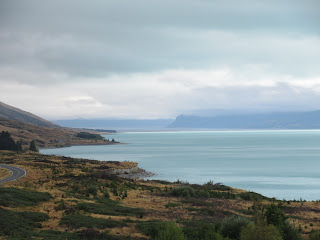
After raining cats and dogs all night long, Diane and I were a little apprehensive of our chances at doing any hiking at Aoraki/Mt. Cook, especially as it continued to drizzle as we drove 75 kms north along the west side of the Caribbean-blue Lake Pukaki, the lake we'd first seen yesterday afternoon.


Mountaineers regard Aoraki/Mt. Cook to be the climbing region in Australasia and it was where the famous New Zealander Edmund Hillary practiced hiking before making his ascent of Mt. Everest in 1953. Fortunately, far less skilled adventurers like Diane and I could still find plenty of satisfaction with mountain walks that led to alpine meadows.


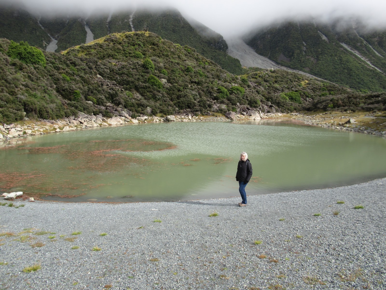
While beginning that hike, we saw a sign that said in the mid-1800s that when the Blue Lakes were named, they were fed by turquoise glacier meltwater filtering through the moraine or rocky debris. The icy blue water was a popular swimming spot in the summer and skating rink in the winter. Today, the Tasman Glacier has shrunk in length and height and water no longer flows from the glacier into the Blue Lakes. The warmer rainwater that now feeds the lakes supports green algae which makes the Blue Lakes green.


It was interesting to learn that the color of the water told us of its origins. Gray or brown water, found close to the glacier, is glacial meltwater with large amounts of 'glacial flour' or ground-up rock in it. Turquoise blue water is glacial meltwater in which much of the 'glacial flour' has settled. The fine particles of rock still suspended give the water its particular turquoise blue color. Green water is generally rainwater and not from the glacier.


The historic first landing on the Tasman Glacier by a ski-equipped single-engine plane was achieved by Harry Wigley on September 22, 1955.


The signs of change were all around us. A hundred years ago, the Mueller Glacier filled the valley floor and we could have walked on the glacier from near this spot. Now though, the glacier was all but hidden up the valley. Glacial ice left behind was still visible at the far end of the lake.


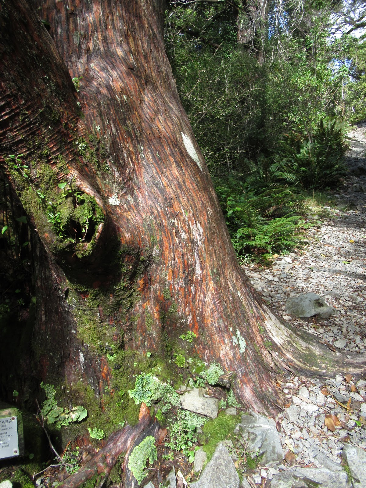
The hike back looked like it was taking through a tunnel of trees and brush.


I am pretty sure this canopy was the upper reaches of the totara trees I'd seen while hiking. Though the hike had been called the Glencoe Stream, there was no water feature on it that I saw!


After raining cats and dogs all night long, Diane and I were a little apprehensive of our chances at doing any hiking at Aoraki/Mt. Cook, especially as it continued to drizzle as we drove 75 kms north along the west side of the Caribbean-blue Lake Pukaki, the lake we'd first seen yesterday afternoon.


Mt. Cook National Park is part of a UNESCO World Heritage area, the so-called Te Waipounamu or South Westland world heritage area. Aoraki/Mt. Cook has two names: one given by European settlers in 1851 after the famous English Captain James Cook. The Aoraki name came from the local Maori and an old Maori legend that said the Southern Alps came into being when a canoe became stranded, and its passengers, including a boy named Aoraki, climbed on top of it and were first frozen by the wind and then turned into stone. The canoe became the South Island and Aoraki and his brothers became the peaks of the Southern Alps. To the Maori Ngai Tahu tribe, Aoraki remains the most sacred ancestor.
I hope you'll enjoy these views along the Mt. Cook Highway toward Aoraki/Mt. Cook National Park.


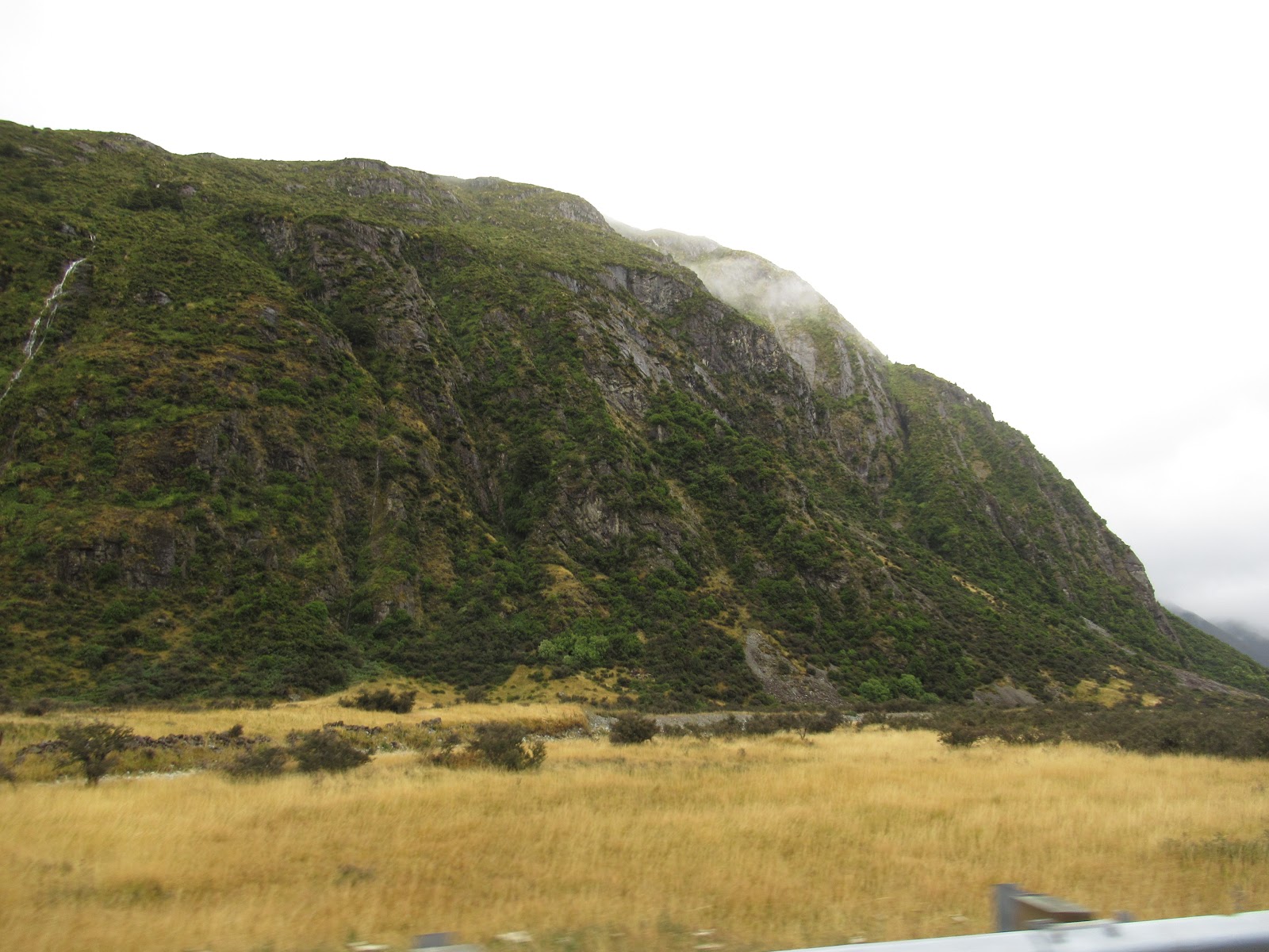

I wrote in a previous post while on the North Island about the many one-way bridges we'd encountered while driving through its gorgeous Coromandel Peninsula. Diane wasn't too thrilled when we saw another of the same bridges as we'd thought and hoped we'd come across the last of them. Unfortunately, no such luck here on the way to the Tasman Glacier!


Before leaving our apartment in Twizel that morning, we'd bundled up making sure to wear every layer we had as it looked so forbidding out. By the time we started the Blue Lakes and Tasman Glacier View Hike, however, we couldn't believe our good fortune with the weather as we thought there'd be a deluge.


As you can see from Diane's gesturing, we headed toward the Blue Lakes first on the hike!


Despite its name, the lake had a decidedly greenish hue.

The berries, though, were a lovely shade of blue. Rarely, Steven, have you and I ever come across blue berries as I recall on our hikes.

Another of the so-called Blue Lakes:


After hiking for about 30 minutes we backtracked after coming to some huge boulders which seemed rather treacherous to get through. We hoped we'd have more luck on the Tasman Glacier Walk.


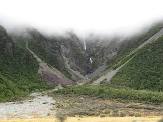
The walk was an easy stroll past the old terminal moraines and gave us an idea of the glacier's more glorious past. We knew the ice, though, had long been receding at a steady rate. The length of Tasman Lake at the Tasman Glacier was 24 km in 2011 but had been shrinking at a rate of 480-820 meters a year and was expected to only measure 20 km long in 2027.


How sad to read about the fast disappearing ice floes on the lake.


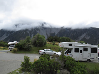
Diane and I were both glad that we didn't have to contend driving a wider vehicle like one of the many campervans (as they call RVs in New Zealand) we saw traveling the highways and byways especially on the country's South Island with its many narrow bridges and roads. We headed from the Tasman Glacier to the nearby Hermitage Hotel, the departure point for our next walk.

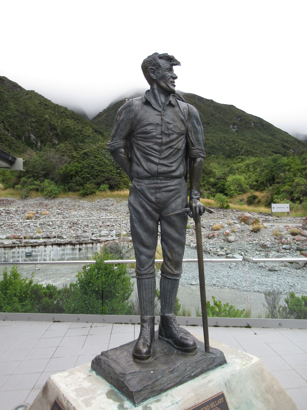
Outside the hotel was the dramatic 7'5" high bronze statue of Sir Edmund Hillary that pointed toward the Southern Alps and Aoraki/Mt. Cook. Crafted by a Dunedin sculptor, the piece took 2500 hours over a period of seven months to create and was based on a photo of Hillary on his 50th birthday taken at The Hermitage Hotel. The life-sized sculpture of the rugged adventurer arrived on May 29th, 2003 at 11:30 am, the same time Hillary was the first to reach the summit of Mount Everest 50 years before with Nepalese Sherpa Tenzing Norgay.
The peak of Aoraki/Mt Cook was shrouded in fog but the temperature had warmed up considerably since that morning.

In the Hillary Alpine Center attached to the hotel, a display marked the dangerous 40' stretch of snow and ice that bars access to the gentler summit slope at Mount Everest. The 28,750' above sea level step had been named the Hillary Step in honor of New Zealand's greatest mountaineer.

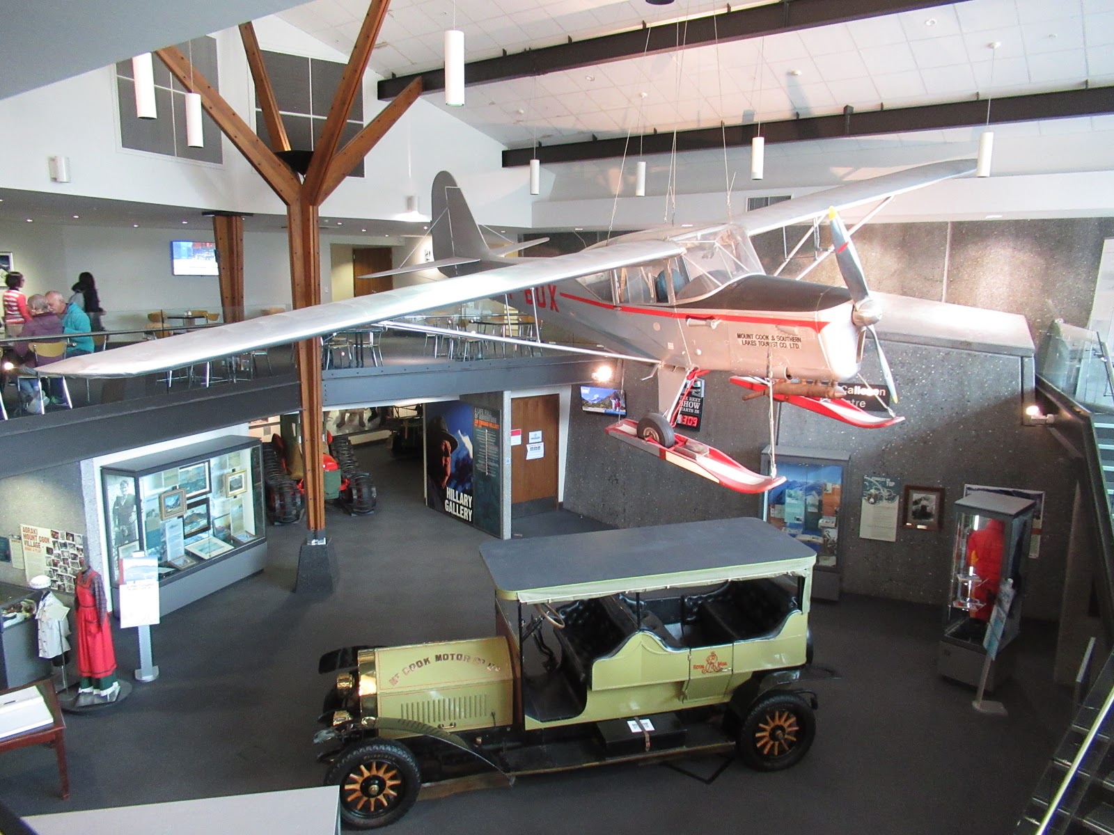
We were surprised at the fair number of old cars and trucks in pristine condition in New Zealand.

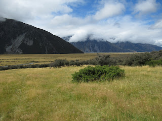
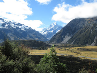
We chose to begin the Hooker Valley Track from the hotel as opposed to from a campground and parking lot nearer the trail so we could first enjoy the beautiful views across the valley and stunning view of Aoraki/Mt. Cook in the distance.


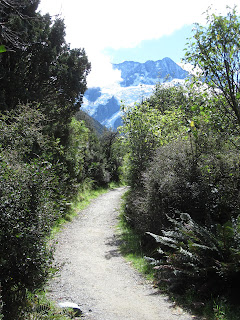
The access trail also took us through a stretch of rainforest where we viewed many of the 200 types of ferns New Zealand is famous for. I could begin to understand why at one time New Zealanders were once called Fernlanders rather than the currently preferred term, Kiwis. More on that in a further post, though!


Having broken both feet in the last two plus years, I trod very carefully across the rock-strewn dry riverbed.

About 45 minutes after leaving the hotel/center, we reached the beginning of the trail. Diane and I were surprised at the absence of information on trail markers, i.e. no distance, time or elevation gain listed. We probably shouldn't have been as the signage generally in New Zealand was quite poor in our estimation and left a lot of navigating to guesswork.


Near the start of the Hooker Valley Track was Freda's Rock. On the 3rd of December, 1910, Freda du Four became the first woman to climb Aoraki/Mt. Cook. This was the spot where the well-known photo of her was taken after her historic climb that she accomplished with the help of two guides. In 1913, Freda completed the Grand Traverse or all three peaks of Aoraki/Mt. Cook. Freda: I thought you'd get a kick out of my making a point of detouring to this part of the track for you.


A little further on was the Alpine Memorial in memory of those who perished in the park when they were overwhelmed by an avalanche on February 22, 1914.


The track through the Hooker Valley toward Aoraki/Mt. Cook was as beautiful as I hope these photos attest.


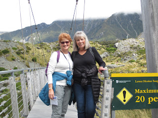
The track was known for its three swing bridges which had sounded really exciting and was one of the reasons why we'd decided to go on this Hooker Valley Track. Our motto had been 'swing bridge or bust.'


Not far from the bridge, Diane's knee began bothering her but she trudged on to the bridge. Depending on your viewpoint, it was either fun or a tad nerve wracking contemplating walking on the bridge as it wasn't named 'swing bridge' for nothing! There was theoretically a limit of just 20 people on the bridge at any one time; I say 'theoretically' as there was no one to monitor at either end of the longish bridge how many people were on it or hoping to walk across it.

I remember Diane's not wanting to pose long while I took this picture as she wanted to get across it and then, just as quickly, return to the other side! If her knee had been OK, it would have been neat for us to have gone the entire length of the track and all three swing bridges but that wasn't realistic.


The views on the way back to the Hermitage Hotel were just unbelievably gorgeous with sun-kissed views of the glacier as the clouds lifted.


The clouds moved in and out, at times affording us absolutely spectacular vistas of Mt. Cook's summit.


As the clouds cleared, we could even pick out hikers' tracks on the upper reaches of the glacier itself.

It was impossible to think of more beautiful views that what we'd been so lucky to see the last hour or so, especially since we were convinced that morning we'd see nothing but clouds covering Aoraki/Mt Cook.


While Diane rested her knee in the hotel cafe, I chose to go by myself on the Glencoe Stream Hike as I knew I would never be back here and I wanted to explore more of the area while it was still early enough in the day.

The hiking brochure described the walk as "zigzagging through totara trees with a ferny understorey." That sounded like it would be very different from the other walks/hikes Diane and I did earlier together. In hindsight, hiking alone was about the dumbest thing I could have done in case I fell, got lost or needed assistance. But fortunately, I'd told Diane where I'd be going and when I expected to be back so she could call for backup if needed.


My hike along the Glencoe Stream was so very peaceful as compared to the Hooker Valley hike which had been packed with people. I was the only soul on this path so I counted myself very fortunate I didn't need any help on some of the hillier parts.

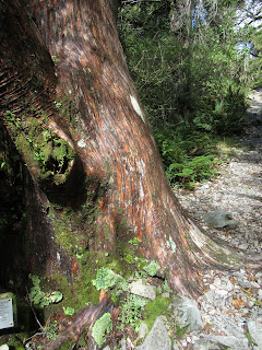
This was a thin-barked totara tree and survived at higher altitudes; it had sweet red berries with seeds at the tip. I remembered the Maori used totara trees for their huge carvings.

I got almost to the top of the hike but decided to turn back as I didn't want to leave Diane alone any longer. Plus, I couldn't imagine hiking any higher could possibly give me any better views of the valley we'd hiked across earlier and also of Aoraki/Mt. Cook than this one did.


I am pretty sure this canopy was the upper reaches of the totara trees I'd seen while hiking. Though the hike had been called the Glencoe Stream, there was no water feature on it that I saw!

After meeting up with Diane again, we drove through Mt. Cook Village where we saw a sign for the Bowen Bush Walk. Diane still didn't feel up to walking on her bum knee, but she was fine with my going on this much shorter forest walk that wandered through a totara and celery pine forest. The latter sounded appealing as I'd never heard of a celery pine forest before.

This was what a mountain celery pine looked like in case you always wondered!

A sign indicated this was turpentine shrub. I'd never given much, if any, thought before as to where turpentine came from but I was still surprised to see a shrub named after the pungent oil.

The walk was delightful and again a very solitary one with tourists most eager to enjoy the more challenging and scenic Hooker Valley Track and other hikes that were for more hard core hikers.


The variety of ferns and other plants was enough for me and gave me a greater sense of the huge biodiversity within the national park.


I'd begun to recognize the totara trees without having to depend on signs or labels.

The walk was an easy forest walk but the absence of signs or trail blazes made it more challenging than I would have thought initially to retrace my steps to where Diane had parked our car. I remember thinking I wish I'd brought bread crumbs like Hansel and Gretel to find my way back!

Lake Pukaki was remarkably still on our drive back to Twizel. Diane commented on the absence of anyone fishing anywhere along the 75 km road back. I hadn't thought about it until she mentioned it but we both wondered why that was the case as the lake surely would have been chock-a-block full of fish and, therefore, a haven for fishermen.

If your image of New Zealand is spectacular mountains and vistas, I think we hit the nail on the head that day as nothing could have been visually more spectacular than our time hiking at Aoraki/Mt. Cook.

Next post: Driving to Queenstown, New Zealand's adventure capital!
Posted on March 25th, 2019, from Littleton, Colorado, a day after flying home from Melbourne, Australia.
Just spectacular vistas and ferns. What a combination.
ReplyDeleteWe were SO blessed by the remarkable weather that day that afforded us unparalleled vistas of the upper reaches of Aoraki/Mt. Cook as it's normally shrouded by clouds. Wish you could also have been there to enjoy it with me, honey.
ReplyDeleteWhat a wonderful/beautiful day you had. Janina
ReplyDeleteJanina, You're so right. I couldn't have imagined a more beautiful and wonderful day seeing New Zealand's glorious sights. Annie
ReplyDeleteWOW! The view of the Glacier is mouthwatering!
ReplyDeleteWe were incredibly fortunate with the fantastic weather we had later in the day so we could see Aoraki/Mt. Cook so clearly.
Delete