I am simultaneously finishing a travel blog about the fantastic 4.5 month long trip Steven and I took last fall to Armenia, Georgia, Azerbaijan, much of Central Asia and then the final six weeks in Spain and Portugal. If you're interested in checking that exciting adventure out, here's the link:
www.bergersadventures6.blogspot.com
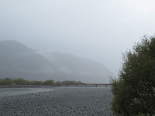
Diane and I needed to leave the town of Franz Joseph in the early morning as we had a long day planned with a flight from Christchurch on the other side of the South Island in the late afternoon on to Melbourne on Australia's south coast. Heading north along the coast toward Hokitika on the South Island's west coast, we were struck yet again by the swirling fog that seemed so prevalent all over New Zealand.
We began heading inland and cross country via the Otira Gorge toward Christchurch.
Never had I seen a 'waterfall' quite like this deluge over a road and this was the 'major cross country highway' too. This part of State Highway 73 over Arthur's Pass was called the Otira Gorge Road.
At the lookout a plaque marking the achievement was unveiled by His Royal Highness, the Duke of Edinburgh, in 1990 but in faraway Wellington, the country's capital located on the North Island. and then transported here.
One that resonated with me was this one that said, "Following the earthquakes, we've al had a chance to reflect on what matters most - our values. Our new gathering places will speak to those values - hospitality, food systems, identity, autonomy and spirituality. We're looking forward to our next chapter with a place that reflects our identity and our land where new stories will be told and new conversations made."
The plans were the main cathedral building would in essence look like it had before the earthquakes as there was a commitment to retain and reinstate as much of its original material and design as possible.
The rails below the bridge commemorate 74 years of public tram services in Christchurch that were operated first with steam locomotives, then horses and finally electric services from 1903 until tram service stopped here in 1954.
Tucked away in a corner of the park were these massive totem pole-looking pieces. A sign said were "a mark of the long burning fires of the Ngai Tahu," the principal Maori tribe of the South Island.
This stunning Whariki design depicted the Maori people's customary rights of gathering and harvesting natural and cultivated foods and other resources from the land and waterways. Maori share their hospitality with others by presenting visitors with delicacies from the area. These designs symbolized edible delicacies such as birds, ferns, vegetation and fish.
www.bergersadventures6.blogspot.com
Diane and I needed to leave the town of Franz Joseph in the early morning as we had a long day planned with a flight from Christchurch on the other side of the South Island in the late afternoon on to Melbourne on Australia's south coast. Heading north along the coast toward Hokitika on the South Island's west coast, we were struck yet again by the swirling fog that seemed so prevalent all over New Zealand.
In the tiny hamlet of Ross, we saw the school that was established in 1875 that was located behind the war memorials. The latter seemed to be a constant feature of every town throughout New Zealand.
From Ross we followed the Glacier Highway a little ways up the coast to the larger town of Hokitika. It would have been a lovely place to spend a few hours if it hadn't been raining because there were lots of galleries, attractive restaurants and even an old-time movie theater.
The famous American philanthropist, Andrew Carnegie, had even built a large library in town.
We stopped at the Kitchen, a restaurant, cafe and deli so Diane could get her daily fix, a flat white coffee, and we could both satisfy our sweet tooth as every town had yummy pastries and the Kitchen was luckily no different!
Another sign to add to my 'bathroom sign collection' - I couldn't help but smile at the 'Whatever!'
After being fortified by both food and shopping, we took the Great Coast Road toward Greymouth, and our last views of the Tasman Sea that we'd been seeing for the last several days.
Thank goodness the raging Big Wahniwahni River didn't reach as high as the road.
Crossing the Taipo River was also pretty exciting as the current seemed strong and the water level was high.
We have so little fog in our native Denver that I certainly didn't mind seeing so much on any of our drives here in New Zealand.
It was very handy knowing how long we had to wait on the one-lane road through much of Otira Gorge.
Never had I seen a 'waterfall' quite like this deluge over a road and this was the 'major cross country highway' too. This part of State Highway 73 over Arthur's Pass was called the Otira Gorge Road.
What a spectacular scenic lookout this was of the Otira Gorge even in the pouring rain. The road marked an important part of New Zealand's engineering heritage when, during the terrible winter of 1865, men toiled here to cut a coach road from Christchurch on the east coast to the gold fields on the west coast. The road was opened in 1866.
A little further on was a turnoff for Death's Corner Scenic Lookout but the name of it was enough to pass up stopping there! Further on, it was nice coming out of the pass and eyeing some flat land once again!
We had some great views of the gorgeous Lake Pearson Wildlife Refuge that was located about 130 kilometers west of Christchurch, our planned final destination in New Zealand.
Further east was Tussocksland National Park located 90 kilometers west of Christchurch. It was there we caught our first glimpse of the sun all day long. None of the country's national parks had any admission fees, nor, as I mentioned in previous posts, any defined entrance or exit so we never knew when and where we entered or left the parks.
While driving through the park, I got a text from Air New Zealand that our flight on to Melbourne was delayed by 2.5 hours. Diane and I decided to spend the unexpected free time exploring more of Christchurch and, in particular, what they call the Central Business District or the city center as North Americans call it.
About 2 pm, a few blocks from downtown Christchurch, we had to stop the car as a flurry of emergency vehicles including an armored vehicle rushed past at breakneck speed with sirens blazing. We knew something devastating must be going on somewhere but had no clue that the violent attacks on two of the city's mosques that left 49 people dead were just then taking place.
I wrote in a previous post that when Diane and I had visited Christchurch about a week earlier, devastating earthquakes in 2010 and 2011 destroyed much of the city’s center. Much of the downtown skyline was filled with massive construction cranes as rebuilding was taking place after the earthquakes.
As we walked around the heart of the center, there was little to 'see' apart from these massive, colorful murals that were the walls in front of the construction sites. In my mind, it's worth clicking on the images to make them larger so you can read the uplifting messages.
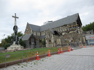
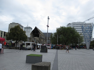
One of the worst hit spots was Cathedral Square and its Christ Church Cathedral in the 2011 earthquake. The tower of the cathedral collapsed and aftershocks cracked the whole cathedral like a plate. Fortunately no lives were lost there. A sign indicated that the Neo-Gothic cathedral, built for the glory of God and one of New Zealand's most significant heritage buildings located in the heart of the city, would be reinstated for the townspeople and for future generations.
It was only about two hours later that we heard of the attacks on the mosques and remarked after the fact how 'normal' everything appeared to us while we were strolling around downtown. There was no police presence at all and no one acted concerned or worried that we noticed, giving any indication or knowledge of the horrific attacks on the mosques so near us.
This Heritage (Bank?) building had been restored after the earthquakes.
There was no sign we noticed as to what this cone-shaped sculptural piece was. We thought it was likely a memorial to those that suffered as a result of the earthquakes but didn't know. I googled the image hoping to find out if that was the case but came up empty.
There were a good half-dozen or more food trucks right in Cathedral Square, not around it. I mentioned to Diane I thought their location in the square seemed a little disrespectful. Perhaps, as Diane commented, it was just a sign of our changing world as food tucks are a common sight all over the world.
The mural series, Life and Hope, portrayed a city's regeneration after the devastation caused by the earthquakes. The lines represented the continuity of life, while the sun and mountains were symbols of constancy in the middle of change. The references to Maori latticework such as tears, strength and the stairway was incorporated in the line work.
A time capsule from 2000 had been deposited beneath the plaque to mark the 150th anniversary of the arrival of the Canterbury Association ships and the beginning of organized European settlement in the province where Christchurch was located.
I knew the city still had a long way to go to finish rebuilding what the earthquake demolished in its downtown core but I was surprised at how sterile and very unappealing the new architecture was that we saw.
A few blocks away was the attractive Victoria Square; in its center was a monument to Queen Victoria who lived from 1819 to 1901.
The base of the monument honored the the memory of the New Zealand troops who deployed from Christchurch and served in South Africa's Boer War that transpired from 1899-1902.
This was such a pretty and novel way to decorate a bench in the square.
The fountain was donated to the city by early settler Henry Layton Bowker who lived from 1840-1921.
This monument behind Diane honored James Cook, the captain in Britain's Royal Navy, who first hoisted his country's flag in New Zealand and explored its seas and coasts from 1769-70, 1773-4 and again in 1777. As you may recall from an earlier post, one of the most famous mountains in the country was called Aoraki/Mt. Cook after the famous circumnavigator.
The historic Hamish Hay Bridge had been renamed in 1989 to honor the former mayor of Christchurch.
This was another example of what I considered was uninviting architecture in the city constructed after the earthquakes.
Tucked away in a corner of the park were these massive totem pole-looking pieces. A sign said were "a mark of the long burning fires of the Ngai Tahu," the principal Maori tribe of the South Island.
The artistic design, called Tree Houses for Swamp Dwellers, was created by Julia Morrison in 2013. It consisted of ten modular objects that read and functioned both as trees and as houses. According to the description, the work incorporated light and plant forms and created spaces within itself for reflection and play.
We left the city center for the airport after this, passing as we found out later very, very close by one of the mosques where so many Muslims tragically lost their lives. It wasn't until we returned our rental car that I received a text from the US consulate telling us to inform family and friends back home that we were safe and hadn't been injured in the attacks. That was a very scary and alarming moment for us even though we, unlike so many locals, were perfectly safe.
The rental company drove us to the airport as we'd received no alert by then from Air New Zealand that our flight to Melbourne wasn't still a go. It was only several hours later after going through security and waiting at the gate that we were informed all flights were cancelled and that the airline wouldn't pay for our stay at a hotel in Christchurch. However, Diane and I were incredibly fortunate that we were able to snag one of the last rooms in the city as all other airline passengers were also looking for a place to rest their weary heads. We were also able to get a flight out early the next day to Melbourne but via flying south to Queenstown where we'd already been twice in the last week. It entailed a long layover there and meant we'd lost a precious day seeing the sights in Melbourne but that was minor compared to the unimaginative hell so many others would face for so long in Christchurch.
Next post: An unexpected travel day exploring more of Queenstown before finally arriving in Melbourne at nighttime.
Posted on April 26th, 2019, from Littleton, Denver's suburb.


